


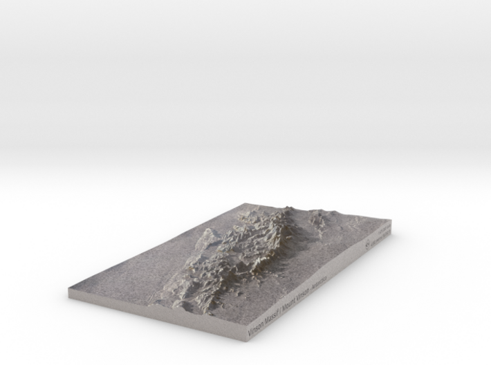
Vinson Massif / Mount Vinson Map
Made by
Print With Shapeways
 Choose Your Material
 Choose your color and finish
$250.49
Have a question about this product?
contact the designerYou must be logged in and verified to contact the designer.
Product Description
Interactive 3D View
If you would like a custom relief map, contact me through my website or through Shapeways. Check out photos of my other 3D prints.
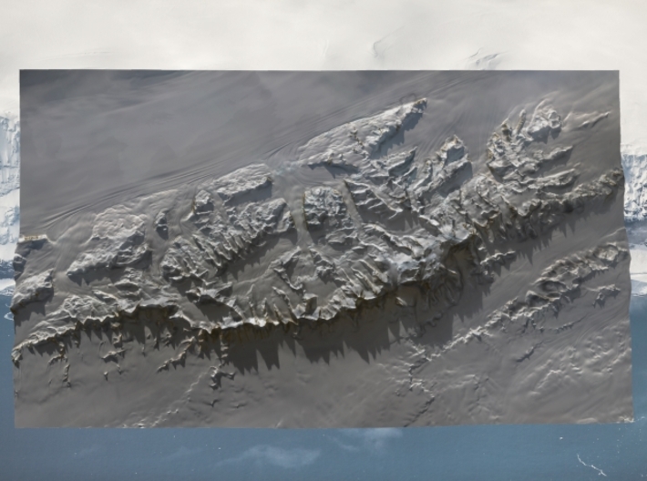
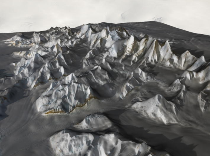
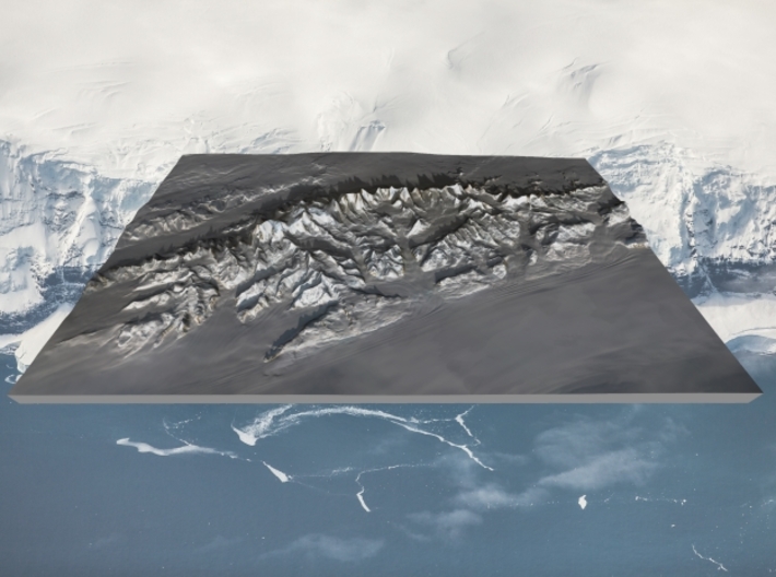
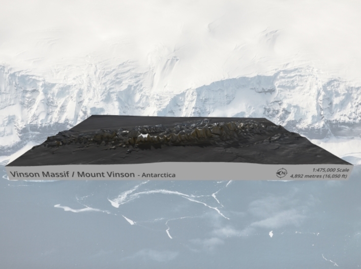
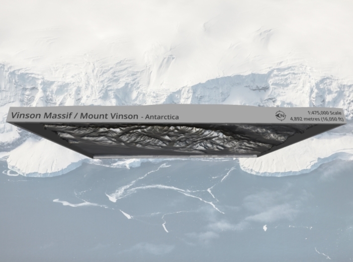
Vinson Massif (/ˈvɪnsən mæˈsiːf/) is a large mountain massif in Antarctica that is 21 km (13 mi) long and 13 km (8.1 mi) wide and lies within the Sentinel Range of the Ellsworth Mountains. It overlooks the Ronne Ice Shelf near the base of the Antarctic Peninsula. The massif is located about 1,200 kilometres (750 mi) from the South Pole. Vinson Massif was discovered in January 1958 by U.S. Navy aircraft. In 1961, the Vinson Massif was named by the Advisory Committee on Antarctic Names (US-ACAN), after Carl G. Vinson, United States congressman from the state of Georgia, for his support for Antarctic exploration. On Nov. 1, 2006, US-ACAN declared Mount Vinson and Vinson Massif to be separate entities.[4][5]
One of the Seven Summits, Mount Vinson is the highest peak in Antarctica, at 4,892 metres (16,050 ft). It lies in the north part of Vinson Massif’s summit plateau in the south portion of the main ridge of the Sentinel Range about 2 kilometres (1.2 mi) north of Hollister Peak.[5] It was first climbed in 1966 by an American team led by Nicholas Clinch. An expedition in 2001 was the first to climb via the Eastern route, and also took GPS measurements of the height of the peak.[6] As of February 2010, 1,400 climbers have attempted to reach the top of Mount Vinson.
Source: Wikipedia
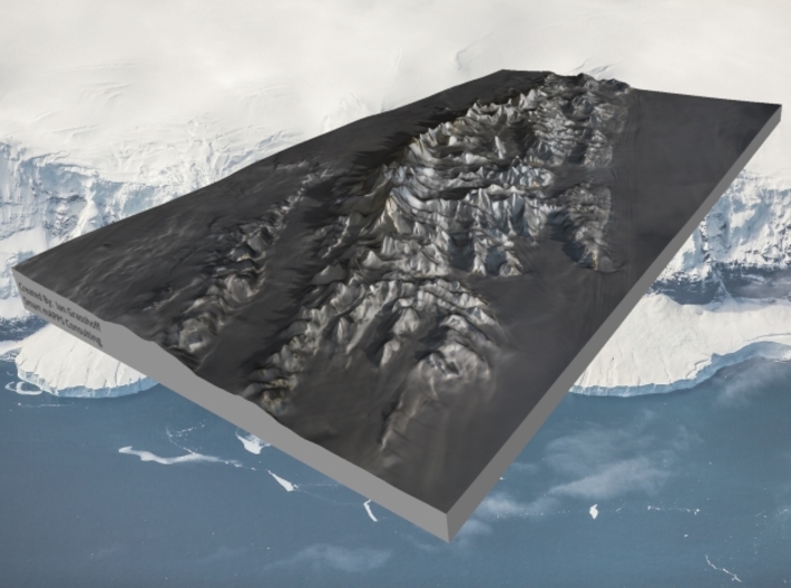
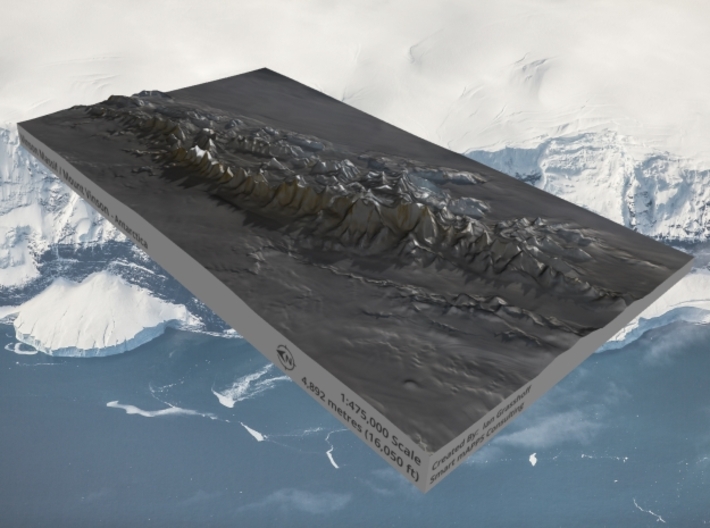
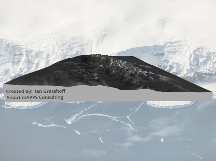
The model is created at a scale of 1:475,000 with 2x vertical exaggeration. It features a built-in base, so it sits perfectly on a desk or in a frame.
Model Data Sources: European Space Agency (ESA)
If you would like a custom relief map, contact me through my website or through Shapeways. Check out photos of my other 3D prints.
Vinson Massif (/ˈvɪnsən mæˈsiːf/) is a large mountain massif in Antarctica that is 21 km (13 mi) long and 13 km (8.1 mi) wide and lies within the Sentinel Range of the Ellsworth Mountains. It overlooks the Ronne Ice Shelf near the base of the Antarctic Peninsula. The massif is located about 1,200 kilometres (750 mi) from the South Pole. Vinson Massif was discovered in January 1958 by U.S. Navy aircraft. In 1961, the Vinson Massif was named by the Advisory Committee on Antarctic Names (US-ACAN), after Carl G. Vinson, United States congressman from the state of Georgia, for his support for Antarctic exploration. On Nov. 1, 2006, US-ACAN declared Mount Vinson and Vinson Massif to be separate entities.[4][5]
One of the Seven Summits, Mount Vinson is the highest peak in Antarctica, at 4,892 metres (16,050 ft). It lies in the north part of Vinson Massif’s summit plateau in the south portion of the main ridge of the Sentinel Range about 2 kilometres (1.2 mi) north of Hollister Peak.[5] It was first climbed in 1966 by an American team led by Nicholas Clinch. An expedition in 2001 was the first to climb via the Eastern route, and also took GPS measurements of the height of the peak.[6] As of February 2010, 1,400 climbers have attempted to reach the top of Mount Vinson.
Source: Wikipedia
The model is created at a scale of 1:475,000 with 2x vertical exaggeration. It features a built-in base, so it sits perfectly on a desk or in a frame.
Model Data Sources: European Space Agency (ESA)
Request a custom order
and get this product personalized just for you
Details
What's in the box:
Vinson-Massif-7x12-475k

Dimensions:
Success Rate:
First To try.
What's this?
Rating:
Mature audiences only.


