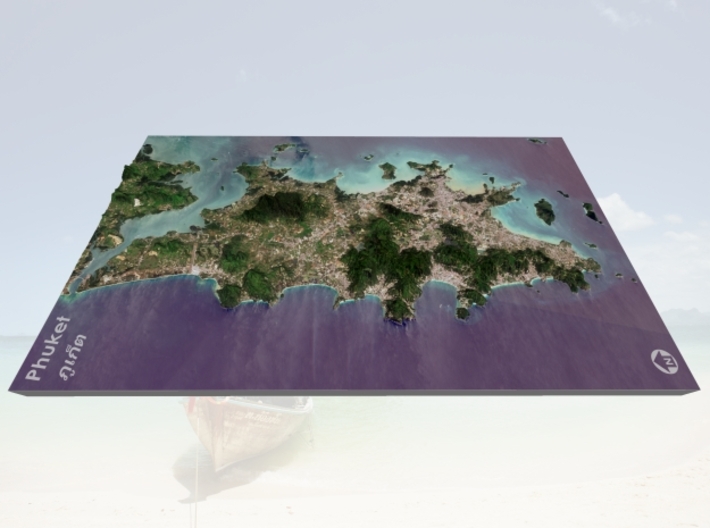


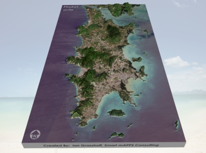

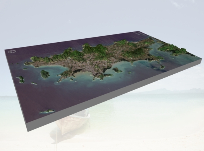

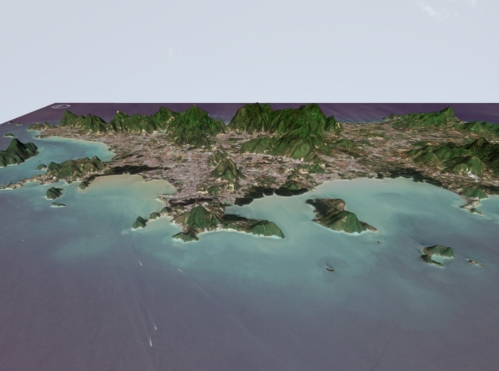

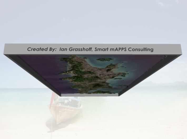

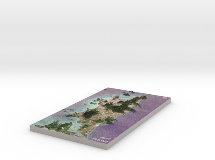
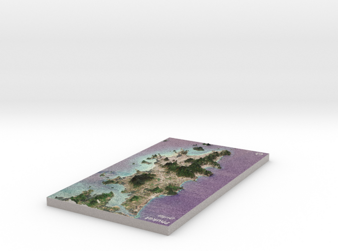
Phuket (ภูเก็ต), Thailand Map: 8"x14"
Made by
Print With Shapeways
 Choose Your Material
 Choose your color and finish
$317.48
Have a question about this product?
contact the designerYou must be logged in and verified to contact the designer.
Product Description
Interactive 3D View
If you would like a custom relief map, contact me through my website or through Shapeways. Check out photos of my other 3D prints.
Phuket (Thai: ภูเก็ต, [pʰūː.kèt] ( listen), Malay: Talang or Tanjung Salang) is one of the southern provinces (changwat) of Thailand. It consists of the island of Phuket, the country's largest island, and another 32 smaller islands off its coast.[1] It lies off the west coast of Thailand in the Andaman Sea. Phuket Island is connected by the Sarasin Bridge to Phang Nga Province to the north. The next nearest province is Krabi, to the east across Phang Nga Bay.
Phuket Province has an area of 576 square kilometres (222 sq mi), somewhat less than that of Singapore, and is the second-smallest province of Thailand. It formerly derived its wealth from tin and rubber, and enjoys a rich and colorful history. The island was on one of the major trading routes between India and China, and was frequently mentioned in foreign ship logs of Portuguese, French, Dutch, and English traders. The region now derives much of its income from tourism.
Source: Wikipedia
The model is created at a scale of 1:150,000 with a vertical exaggeration of 3.5x. It features a built-in base, so it sits perfectly on a desk or in a frame.
Model Data Sources: Jaxa (Elevation), European Space Agency (Imagery)
Request a custom order
and get this product personalized just for you
Details
What's in the box:
Phuket-8x14-150k
Dimensions:
Success Rate:
First To try.
What's this?
Rating:
Mature audiences only.


