


Chain O' Lakes Bathymetry Map: 8"x10"
Made by
Print With Shapeways
 Choose Your Material
 Choose your color and finish
$261.57
Have a question about this product?
contact the designerYou must be logged in and verified to contact the designer.
Product Description
Interactive 3D View
If you would like a custom relief map, contact me through my website or through Shapeways. Check out photos of my other 3D prints.
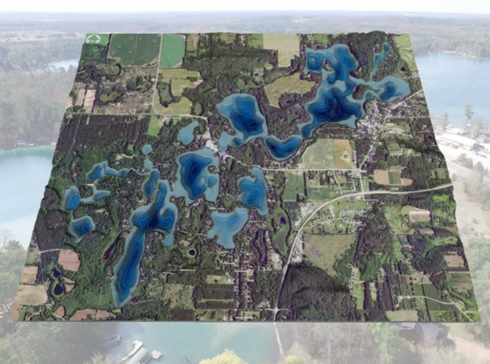
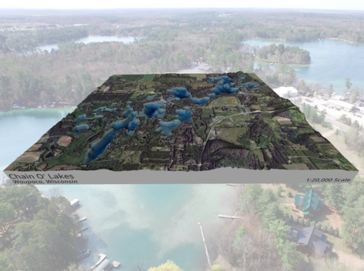
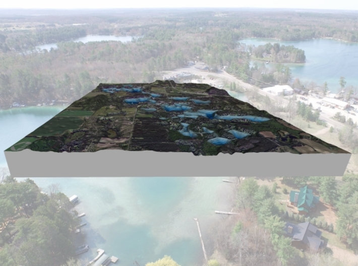
The Chain of Lakes is an impressive natural feature created by a receding lobe of the great Cary Glacier which melted approximately 12,500 years ago, leaving irregular hills and valleys. Organic matter plus deposits of sand, gravel and rocks trapped in the mass fell to the bottom of the valleys, creating their unique terrain. Great chunks of ice melted in the deep pits, forming today's lakes of the Chain. The melting ice uncovered natural springs opened by the movement of the glacier. These natural springs feed the lakes with remarkably pure water, and natural filtration keeps the lakes crystal clear by continually releasing fresh spring water while older water empties through the Crystal River outlet.
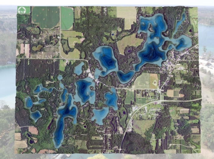
The water of the lakes is translucent; the greenish-blue color comes from the reflection of unique materials at the bottom of each lake. Varying levels of limestone, clay, alkaline and glacially deposited organic material create different tints of green on the surface of the lakes. Deep emerald tints are especially vivid on Marl, Taylor, McCrossen, Nessling and Round lakes. The unique colors are one of the trademark characteristics of the Chain, oftentimes referred to as the Killarneys of The Americas.
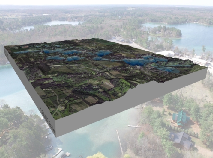
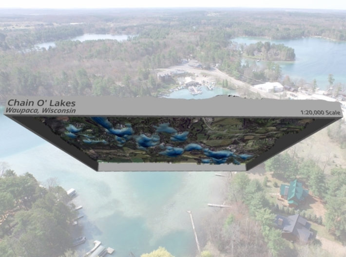
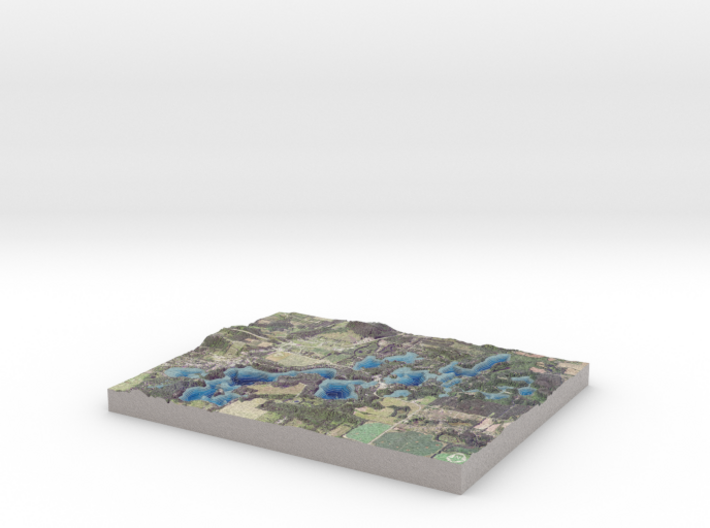
The model is created at a scale of 1:20,000 with 5x vertical exaggeration. It features a built-in base, so it sits perfectly on a desk or in a frame.
Model Data Sources: Imagery (USDA), Elevation Data (Waupaca County), Bathymetry (Point Mapping, LLC)
If you would like a custom relief map, contact me through my website or through Shapeways. Check out photos of my other 3D prints.
The Chain of Lakes is an impressive natural feature created by a receding lobe of the great Cary Glacier which melted approximately 12,500 years ago, leaving irregular hills and valleys. Organic matter plus deposits of sand, gravel and rocks trapped in the mass fell to the bottom of the valleys, creating their unique terrain. Great chunks of ice melted in the deep pits, forming today's lakes of the Chain. The melting ice uncovered natural springs opened by the movement of the glacier. These natural springs feed the lakes with remarkably pure water, and natural filtration keeps the lakes crystal clear by continually releasing fresh spring water while older water empties through the Crystal River outlet.
The water of the lakes is translucent; the greenish-blue color comes from the reflection of unique materials at the bottom of each lake. Varying levels of limestone, clay, alkaline and glacially deposited organic material create different tints of green on the surface of the lakes. Deep emerald tints are especially vivid on Marl, Taylor, McCrossen, Nessling and Round lakes. The unique colors are one of the trademark characteristics of the Chain, oftentimes referred to as the Killarneys of The Americas.
The model is created at a scale of 1:20,000 with 5x vertical exaggeration. It features a built-in base, so it sits perfectly on a desk or in a frame.
Model Data Sources: Imagery (USDA), Elevation Data (Waupaca County), Bathymetry (Point Mapping, LLC)
Details
What's in the box:
Chain-O-Lakes-8x10-20k

Dimensions:
Success Rate:
First To try.
What's this?
Rating:
Mature audiences only.


