


Hawai'i, The Big Island: 9.25"x10.5"
Made by
Print With Shapeways
 Choose Your Material
 Choose your color and finish
$273.83
Have a question about this product?
contact the designerYou must be logged in and verified to contact the designer.
Product Description
Interactive 3D View
If you would like a custom relief map, contact me through my website or through Shapeways. Check out photos of my other 3D prints.
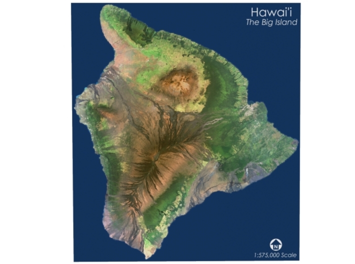
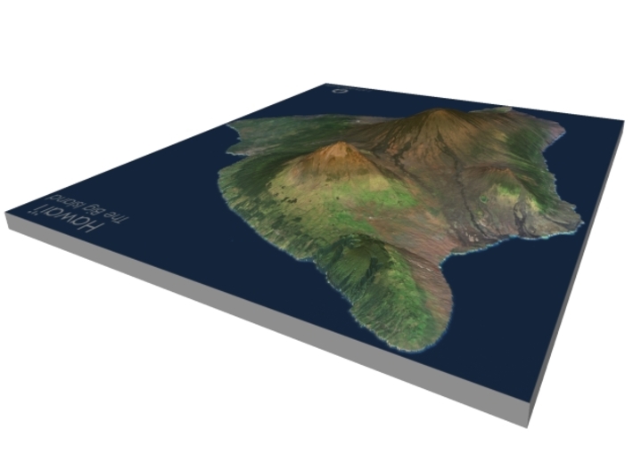
Hawaiʻi is the largest island located in the U.S. state of Hawaii. It is the largest and the southeastern-most of the Hawaiian Islands, a chain of volcanic islands in the North Pacific Ocean. With an area of 4,028 square miles (10,430 km2), it has 63% of the Hawaiian archipelago's combined landmass, and is the largest island in the United States. However, it only has 13% of Hawaiʻi’s people. The island of Hawaiʻi is the third largest island in Polynesia, behind the two main islands of New Zealand.[3]
The island is often referred to as the Island of Hawaiʻi,[4] the Big Island, or Hawaiʻi Island to distinguish it from the state. Administratively, the whole island is encompassed by Hawaiʻi County.
As of the 2010 Census the population was 185,079.[5] The county seat and largest city is Hilo. There are no incorporated cities in Hawaiʻi County (see List of counties in Hawaii).
Source: Wikipedia
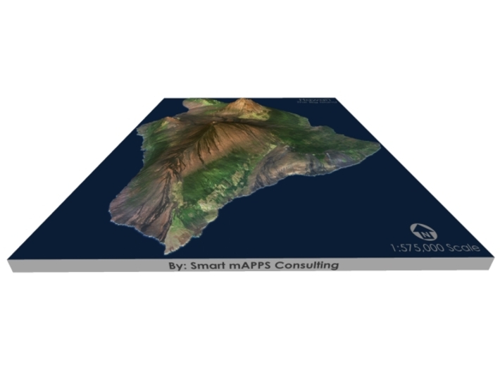
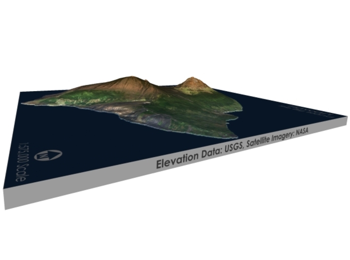
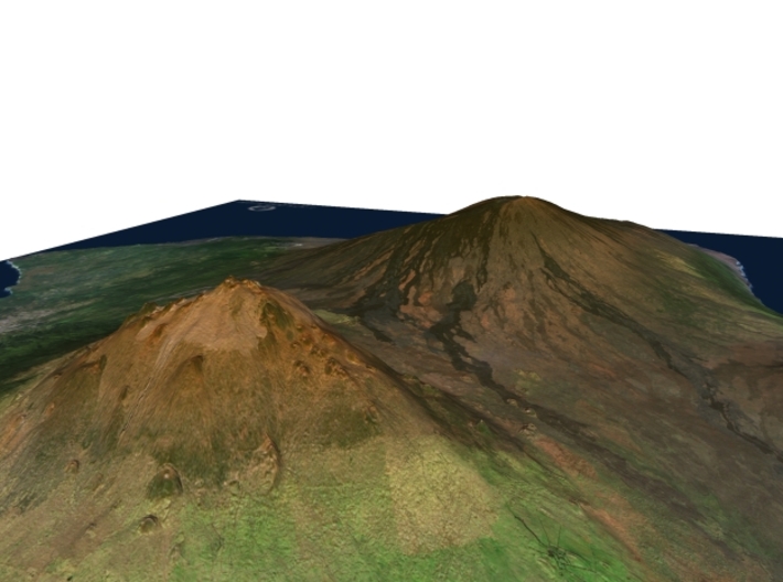
The model is created at a scale of 1:575,000 with 3.5x vertical exaggeration. It features a built-in base, so it sits perfectly on a desk or in a frame.
Model Data Sources - Elevation Data: USGS, Satellite Imagery: NASA
If you would like a custom relief map, contact me through my website or through Shapeways. Check out photos of my other 3D prints.
Hawaiʻi is the largest island located in the U.S. state of Hawaii. It is the largest and the southeastern-most of the Hawaiian Islands, a chain of volcanic islands in the North Pacific Ocean. With an area of 4,028 square miles (10,430 km2), it has 63% of the Hawaiian archipelago's combined landmass, and is the largest island in the United States. However, it only has 13% of Hawaiʻi’s people. The island of Hawaiʻi is the third largest island in Polynesia, behind the two main islands of New Zealand.[3]
The island is often referred to as the Island of Hawaiʻi,[4] the Big Island, or Hawaiʻi Island to distinguish it from the state. Administratively, the whole island is encompassed by Hawaiʻi County.
As of the 2010 Census the population was 185,079.[5] The county seat and largest city is Hilo. There are no incorporated cities in Hawaiʻi County (see List of counties in Hawaii).
Source: Wikipedia
The model is created at a scale of 1:575,000 with 3.5x vertical exaggeration. It features a built-in base, so it sits perfectly on a desk or in a frame.
Model Data Sources - Elevation Data: USGS, Satellite Imagery: NASA
Details
What's in the box:
BigIsland-9.25x10.5

Dimensions:
Success Rate:
First To try.
What's this?
Rating:
Mature audiences only.


