


Mount Mansfield / Stowe Mountain: 6"
Made by
Print With Shapeways
 Choose Your Material
 Choose your color and finish
$152.56
Have a question about this product?
contact the designerYou must be logged in and verified to contact the designer.
Product Description
Interactive 3D View
If you would like a custom relief map, contact me through my website or through Shapeways. Check out photos of my other 3D prints.
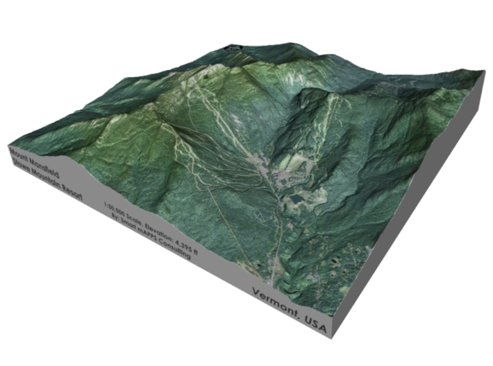
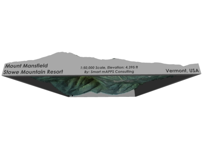
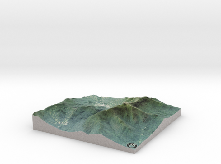
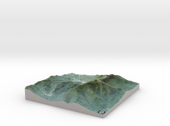
Mount Mansfield is the highest mountain in Vermont with a summit that peaks at 4,395 feet (1,340 m) above sea level. The summit is located within the town of Underhill in Chittenden County; the ridgeline, including some secondary peaks, extends into the town of Stowe in Lamoille County, and the mountain's flanks also reach into the town of Cambridge.
Stowe Mountain Resort is a ski resort in the northeastern United States, near the town of Stowe in northern Vermont, comprising two separate mountains: Mount Mansfield and Spruce Peak. The lift-served vertical drop of Mount Mansfield is 2,360 feet (719 m), the fifth largest in New England and the fourth largest in Vermont.
Source: Wikipedia
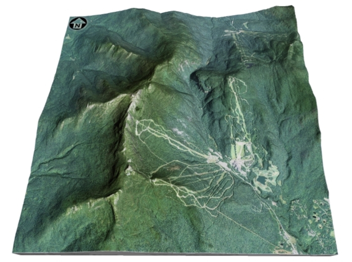
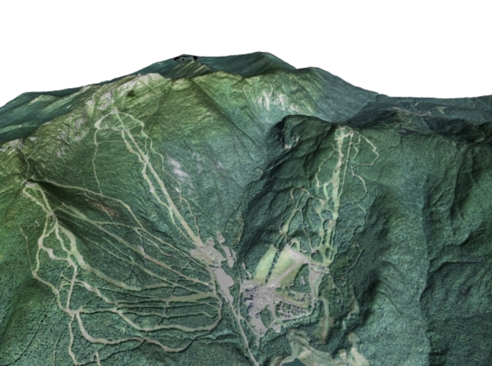
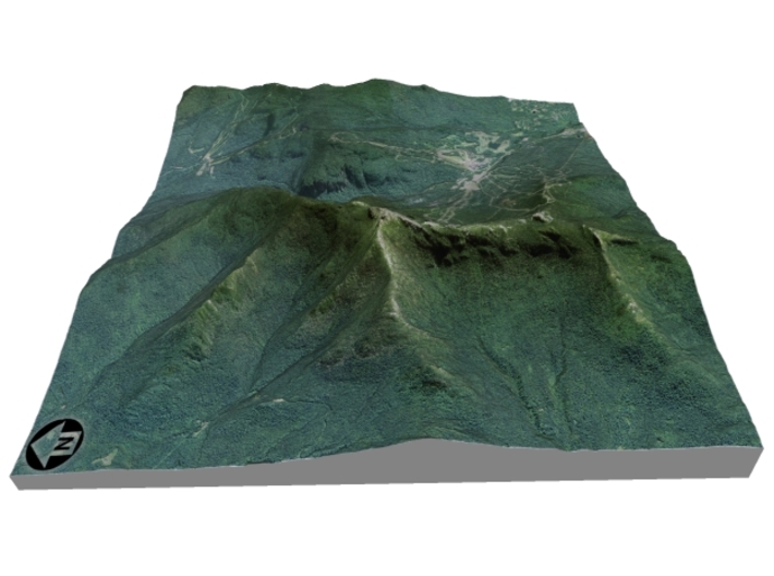
The model is created at a scale of 1:50,000 with 1.25x vertical exaggeration. It features a built-in base, so it sits perfectly on a desk or in a frame.
Model Data Sources: USDA, USGS
If you would like a custom relief map, contact me through my website or through Shapeways. Check out photos of my other 3D prints.
Mount Mansfield is the highest mountain in Vermont with a summit that peaks at 4,395 feet (1,340 m) above sea level. The summit is located within the town of Underhill in Chittenden County; the ridgeline, including some secondary peaks, extends into the town of Stowe in Lamoille County, and the mountain's flanks also reach into the town of Cambridge.
Stowe Mountain Resort is a ski resort in the northeastern United States, near the town of Stowe in northern Vermont, comprising two separate mountains: Mount Mansfield and Spruce Peak. The lift-served vertical drop of Mount Mansfield is 2,360 feet (719 m), the fifth largest in New England and the fourth largest in Vermont.
Source: Wikipedia
The model is created at a scale of 1:50,000 with 1.25x vertical exaggeration. It features a built-in base, so it sits perfectly on a desk or in a frame.
Model Data Sources: USDA, USGS
Details
What's in the box:
Mt-Mansfield-6x6-50k
Dimensions:
Success Rate:
First To try.
What's this?
Rating:
Mature audiences only.


