


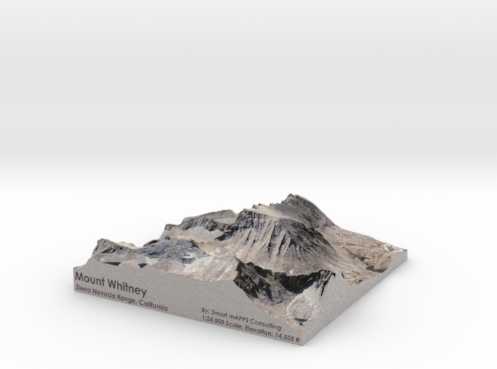
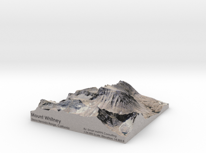
Mount Whitney Color: 6"x6"
Made by
Print With Shapeways
 Choose Your Material
 Choose your color and finish
$126.91
Have a question about this product?
contact the designerYou must be logged in and verified to contact the designer.
Product Description
Interactive 3D View
If you would like a custom relief map, contact me through my website or through Shapeways. Check out photos of my other 3D prints.
Other Options
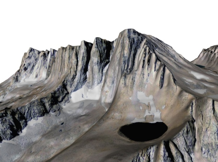
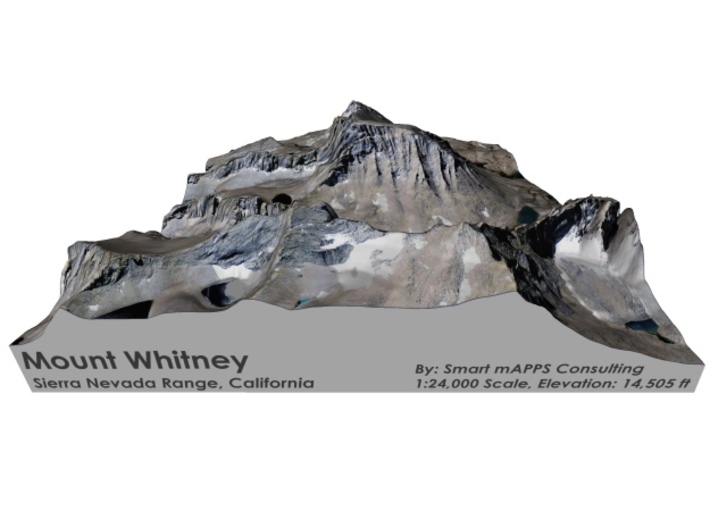
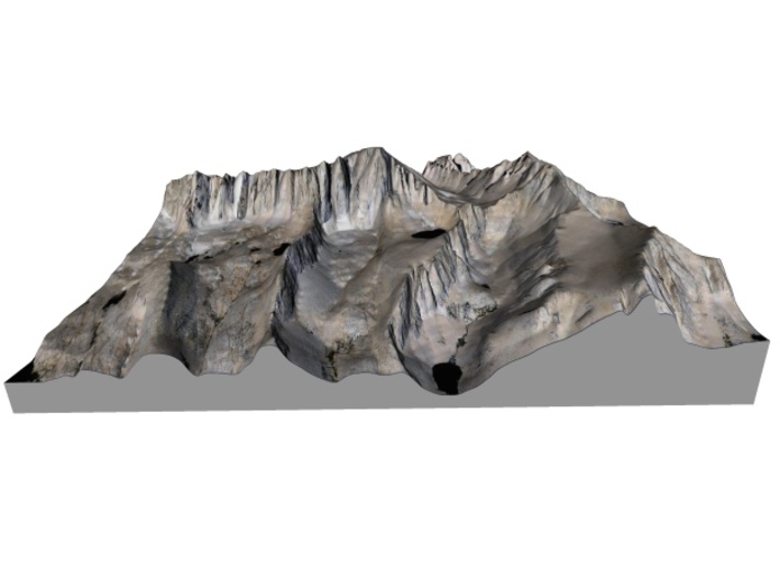
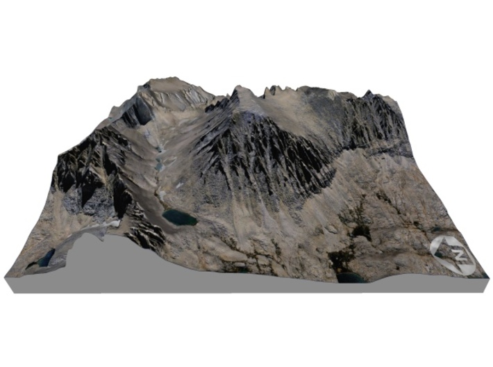
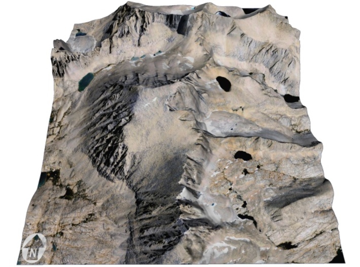
Mount Whitney is the highest summit in the contiguous United States and the Sierra Nevada, with an elevation of 14,505 feet (4,421 m).[5] It is on the boundary between California's Inyo and Tulare counties, 84.6 miles (136.2 km)[8] west-northwest of the lowest point in North America at Badwater Basin in Death Valley National Park at 282 ft (86 m) below sea level.[9] The west slope of the mountain is in Sequoia National Park and the summit is the southern terminus of the John Muir Trail which runs 211.9 mi (341.0 km) from Happy Isles in Yosemite Valley.[10] The east slope is in the Inyo National Forest in Inyo County.
Source: Wikipedia
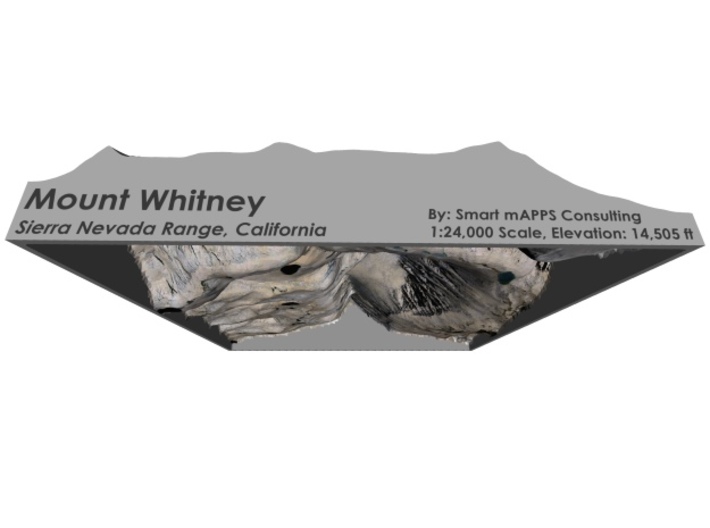
The model is created at a scale of 1:24,000 with no vertical exaggeration. It features a built-in base, so it sits perfectly on a desk or in a frame.
Model Data Sources: USDA, USGS
If you would like a custom relief map, contact me through my website or through Shapeways. Check out photos of my other 3D prints.
Other Options
Mount Whitney is the highest summit in the contiguous United States and the Sierra Nevada, with an elevation of 14,505 feet (4,421 m).[5] It is on the boundary between California's Inyo and Tulare counties, 84.6 miles (136.2 km)[8] west-northwest of the lowest point in North America at Badwater Basin in Death Valley National Park at 282 ft (86 m) below sea level.[9] The west slope of the mountain is in Sequoia National Park and the summit is the southern terminus of the John Muir Trail which runs 211.9 mi (341.0 km) from Happy Isles in Yosemite Valley.[10] The east slope is in the Inyo National Forest in Inyo County.
Source: Wikipedia
The model is created at a scale of 1:24,000 with no vertical exaggeration. It features a built-in base, so it sits perfectly on a desk or in a frame.
Model Data Sources: USDA, USGS
Details
What's in the box:
Mt-Whitney-6x6-24k-color
Dimensions:
Success Rate:
First To try.
What's this?
Rating:
Mature audiences only.


