


Mount Elbert Map: 6"x9"
Made by
Print With Shapeways
 Choose Your Material
 Choose your color and finish
$207.00
Have a question about this product?
contact the designerYou must be logged in and verified to contact the designer.
Product Description
Interactive 3D Viewer
If you would like a custom relief map, contact me through my website or through Shapeways.
Check out some photos of my other work here.
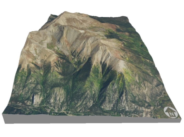
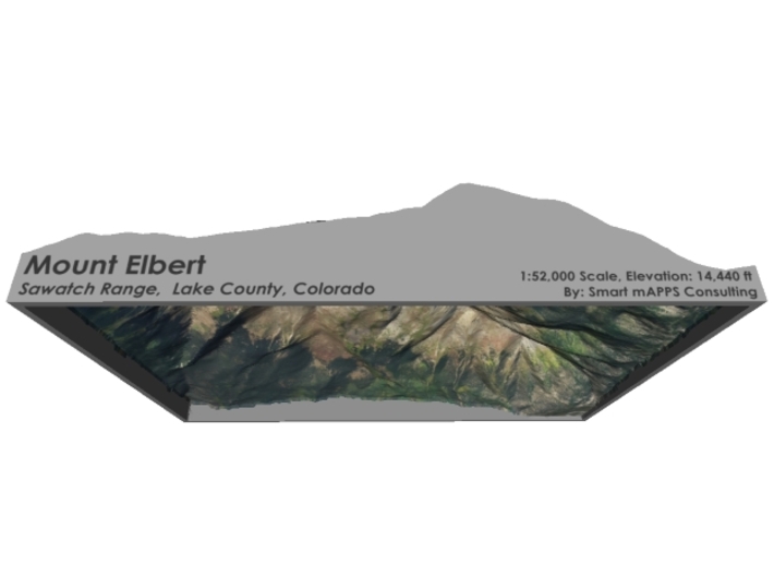
Mount Elbert is the highest summit of the Rocky Mountains of North America and the highest point in the U.S. state of Colorado and the entire Mississippi River drainage basin. The ultra-prominent 14,440-foot (4401.2 m) fourteener is the highest peak in the Sawatch Range and the second-highest summit in the contiguous United States after Mount Whitney. Mount Elbert is located in San Isabel National Forest, 12.1 miles (19.4 km) southwest (bearing 223°) of the City of Leadville in Lake County, Colorado.
The mountain was named in honor of Colorado statesman Samuel Hitt Elbert, who was active in the formative period of the state and Governor of the Territory of Colorado from 1873 to 1874. Henry W. Stuckle of the Hayden Survey was the first to record an ascent of the peak, in 1874. The easiest and most popular climbing routes are categorized as Class 1 to 2 or A+ in mountaineering parlance. Mount Elbert is therefore often referred to as the "gentle giant" that tops all others in the Rocky Mountains.
Source: Wikipedia
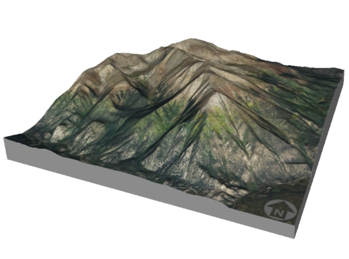
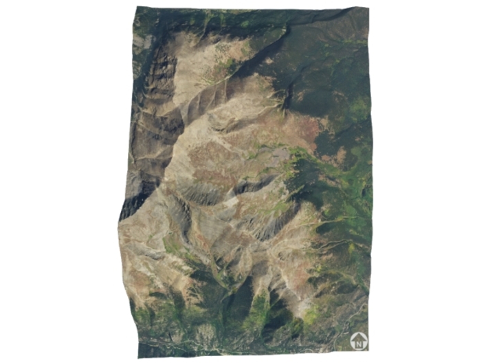
The model is created at a scale of 1:52,000 with 1.5x vertical exaggeration. It features a built-in base, so it sits perfectly on a desk or in a frame.
Model Data Sources: USDA, USGS
If you would like a custom relief map, contact me through my website or through Shapeways.
Check out some photos of my other work here.
Mount Elbert is the highest summit of the Rocky Mountains of North America and the highest point in the U.S. state of Colorado and the entire Mississippi River drainage basin. The ultra-prominent 14,440-foot (4401.2 m) fourteener is the highest peak in the Sawatch Range and the second-highest summit in the contiguous United States after Mount Whitney. Mount Elbert is located in San Isabel National Forest, 12.1 miles (19.4 km) southwest (bearing 223°) of the City of Leadville in Lake County, Colorado.
The mountain was named in honor of Colorado statesman Samuel Hitt Elbert, who was active in the formative period of the state and Governor of the Territory of Colorado from 1873 to 1874. Henry W. Stuckle of the Hayden Survey was the first to record an ascent of the peak, in 1874. The easiest and most popular climbing routes are categorized as Class 1 to 2 or A+ in mountaineering parlance. Mount Elbert is therefore often referred to as the "gentle giant" that tops all others in the Rocky Mountains.
Source: Wikipedia
The model is created at a scale of 1:52,000 with 1.5x vertical exaggeration. It features a built-in base, so it sits perfectly on a desk or in a frame.
Model Data Sources: USDA, USGS
Details
What's in the box:
Mt-Elbert-6x9-52k

Dimensions:
Success Rate:
First To try.
What's this?
Rating:
Mature audiences only.


