


Koko Crater Map: 6"x6"
Made by
Print With Shapeways
 Choose Your Material
 Choose your color and finish
$139.83
Have a question about this product?
contact the designerYou must be logged in and verified to contact the designer.
Product Description
Interactive 3D View
If you would like a custom relief map, contact me through my website or through Shapeways.
Check out some photos of my other work here.
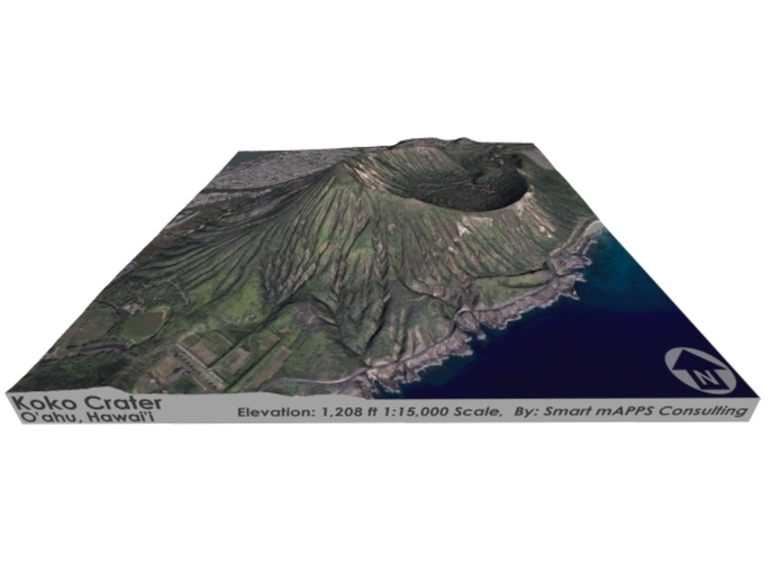
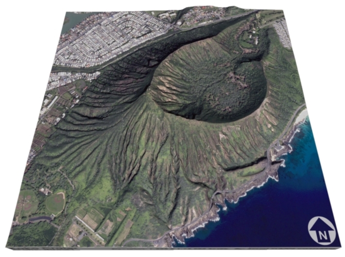
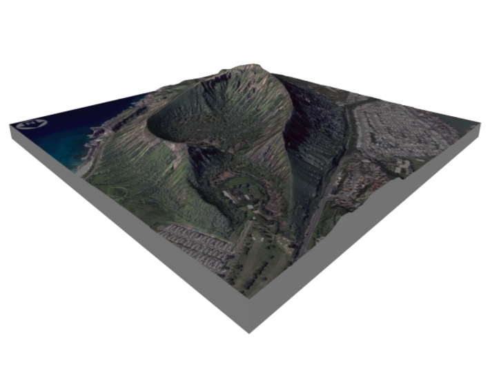
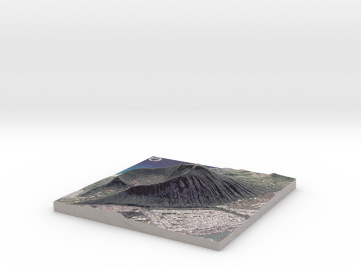
Koko Head is the headland that defines the eastern side of Maunalua Bay along the southeastern side of the Island of Oʻahu in Hawaiʻi. On its western slope is the community of Portlock, a part of Hawaiʻi Kai. Koko Head (at 642 ft or 196 m) is an ancient tuff cone that is somewhat dwarfed by its neighboring tuff cone, Koko Crater, with its peak, Kohelepelepe (or Puʻu Mai), rising to 1208 ft or 368 m. Koko Head itself has three significant depressions or old vents, the largest of which forms the well-known Hanauma Bay. Koko Head's last eruption was 30,000–35,000 years ago.
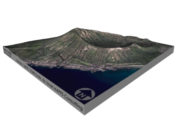
Koko Crater is a large tuff cone that visually dominates the area. Within the crater are horse stables and the Koko Crater Botanical Garden specializing in cacti and succulents.
Source: Wikipedia
The model is created at a scale of 1:15,000 with NO vertical exaggeration. It features a built-in base, so it sits perfectly on a desk or in a frame.
Model Data Sources: USGS
If you would like a custom relief map, contact me through my website or through Shapeways.
Check out some photos of my other work here.
Koko Head is the headland that defines the eastern side of Maunalua Bay along the southeastern side of the Island of Oʻahu in Hawaiʻi. On its western slope is the community of Portlock, a part of Hawaiʻi Kai. Koko Head (at 642 ft or 196 m) is an ancient tuff cone that is somewhat dwarfed by its neighboring tuff cone, Koko Crater, with its peak, Kohelepelepe (or Puʻu Mai), rising to 1208 ft or 368 m. Koko Head itself has three significant depressions or old vents, the largest of which forms the well-known Hanauma Bay. Koko Head's last eruption was 30,000–35,000 years ago.
Koko Crater is a large tuff cone that visually dominates the area. Within the crater are horse stables and the Koko Crater Botanical Garden specializing in cacti and succulents.
Source: Wikipedia
The model is created at a scale of 1:15,000 with NO vertical exaggeration. It features a built-in base, so it sits perfectly on a desk or in a frame.
Model Data Sources: USGS
Details
What's in the box:
koko-crater-6x6-15k

Dimensions:
Success Rate:
First To try.
What's this?
Rating:
Mature audiences only.


