


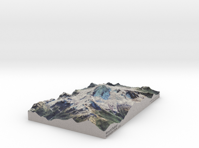
Mount Baker Map: 6"x9"
Made by
Print With Shapeways
 Choose Your Material
 Choose your color and finish
$205.94
Have a question about this product?
contact the designerYou must be logged in and verified to contact the designer.
Product Description
Interactive 3D View
If you would like a custom relief map, contact me through my website or through Shapeways.
Check out some photos of my other work here.
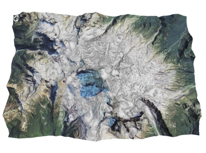
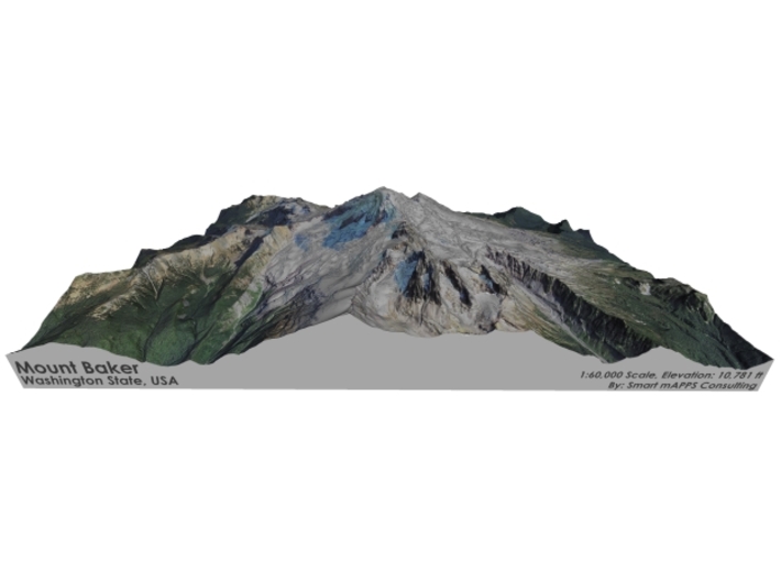
Mount Baker (Lummi: Qwú’mə Kwəlshéːn; Nooksack: Kw’eq Smaenit or Kwelshán), also known as Koma Kulshan or simply Kulshan, is an active[9] glaciated andesitic stratovolcano [4] in the Cascade Volcanic Arc and the North Cascades of Washington in the United States. Mount Baker has the second-most thermally active crater in the Cascade Range after Mount Saint Helens.[10] About 31 miles (50 km)[11] due east of the city of Bellingham, Whatcom County, Mount Baker is the youngest volcano in the Mount Baker volcanic field.[5] While volcanism has persisted here for some 1.5 million years, the current glaciated cone is likely no more than 140,000 years old, and possibly no older than 80–90,000 years. Older volcanic edifices have mostly eroded away due to glaciation.
After Mount Rainier, Mount Baker is the most heavily glaciated of the Cascade Range volcanoes; the volume of snow and ice on Mount Baker, 0.43 cu mi (1.79 km3) is greater than that of all the other Cascades volcanoes (except Rainier) combined. It is also one of the snowiest places in the world; in 1999, Mount Baker Ski Area, located 14 km (8.7 mi) to the northeast, set the world record for recorded snowfall in a single season—1,140 in (2,900 cm).
Source: Wikipedia
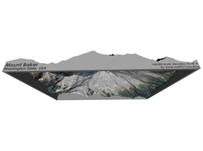
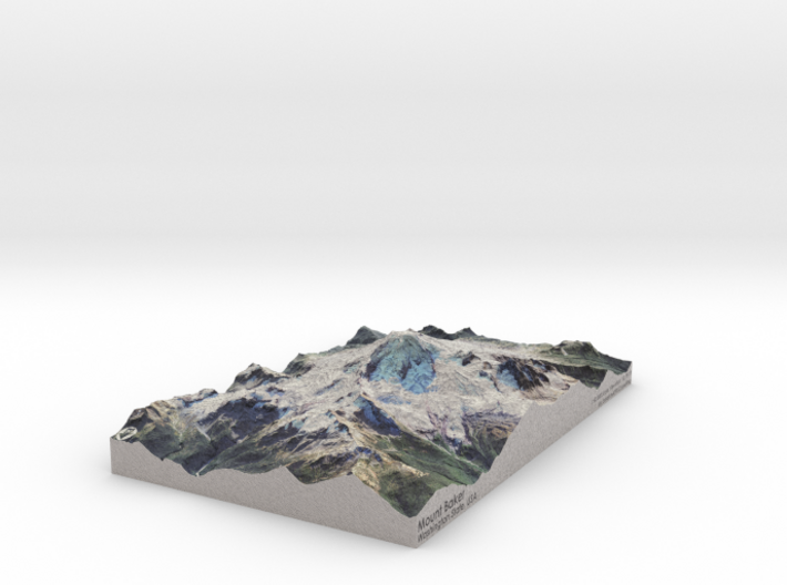
The model is created at a scale of 1:60,000 with NO vertical exaggeration. It features a built-in base, so it sits perfectly on a desk or in a frame.
Model Data Sources: USDA, USGS
If you would like a custom relief map, contact me through my website or through Shapeways.
Check out some photos of my other work here.
Mount Baker (Lummi: Qwú’mə Kwəlshéːn; Nooksack: Kw’eq Smaenit or Kwelshán), also known as Koma Kulshan or simply Kulshan, is an active[9] glaciated andesitic stratovolcano [4] in the Cascade Volcanic Arc and the North Cascades of Washington in the United States. Mount Baker has the second-most thermally active crater in the Cascade Range after Mount Saint Helens.[10] About 31 miles (50 km)[11] due east of the city of Bellingham, Whatcom County, Mount Baker is the youngest volcano in the Mount Baker volcanic field.[5] While volcanism has persisted here for some 1.5 million years, the current glaciated cone is likely no more than 140,000 years old, and possibly no older than 80–90,000 years. Older volcanic edifices have mostly eroded away due to glaciation.
After Mount Rainier, Mount Baker is the most heavily glaciated of the Cascade Range volcanoes; the volume of snow and ice on Mount Baker, 0.43 cu mi (1.79 km3) is greater than that of all the other Cascades volcanoes (except Rainier) combined. It is also one of the snowiest places in the world; in 1999, Mount Baker Ski Area, located 14 km (8.7 mi) to the northeast, set the world record for recorded snowfall in a single season—1,140 in (2,900 cm).
Source: Wikipedia
The model is created at a scale of 1:60,000 with NO vertical exaggeration. It features a built-in base, so it sits perfectly on a desk or in a frame.
Model Data Sources: USDA, USGS
Details
What's in the box:
Mt-Baker-6x9-60k
Dimensions:
Success Rate:
First To try.
What's this?
Rating:
Mature audiences only.


