


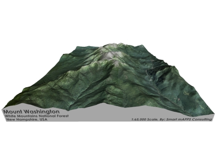


Mount Washington Map: 8.5"x11"
Made by
Print With Shapeways
 Choose Your Material
 Choose your color and finish
$288.89
Have a question about this product?
contact the designerYou must be logged in and verified to contact the designer.
Product Description
Interactive 3D View
If you would like a custom relief map, contact me through my website or through Shapeways.
Check out some photos of my other work here.
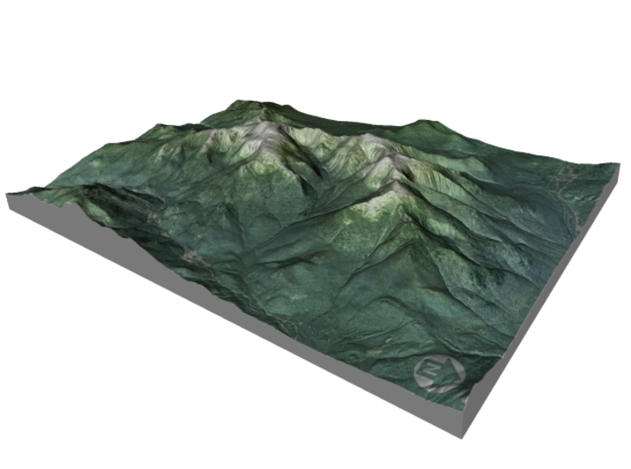
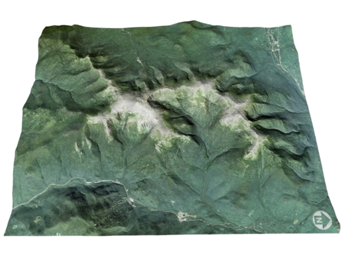
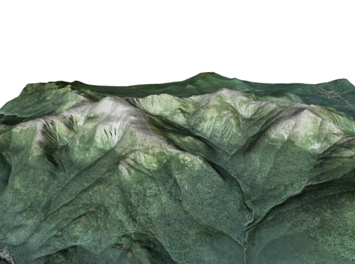
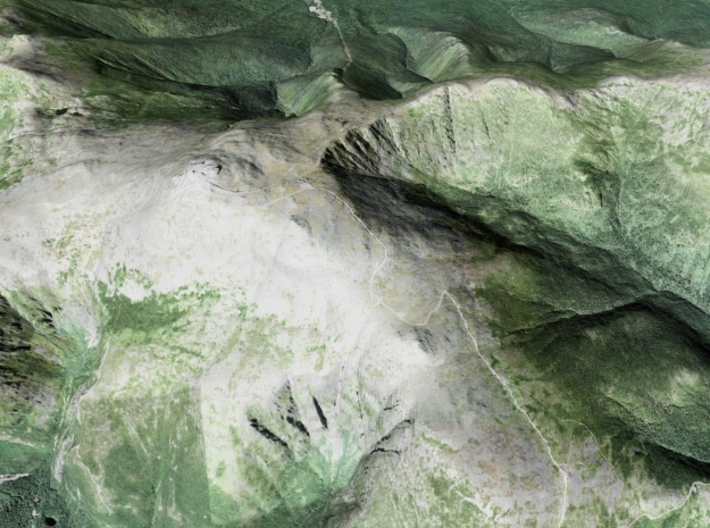
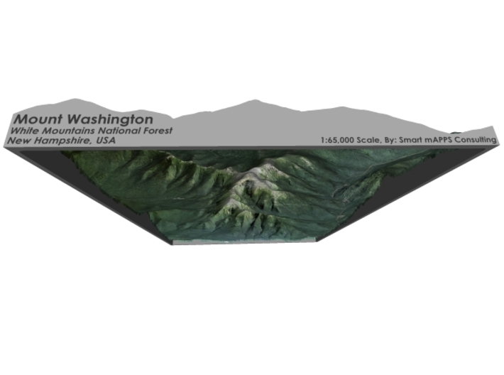
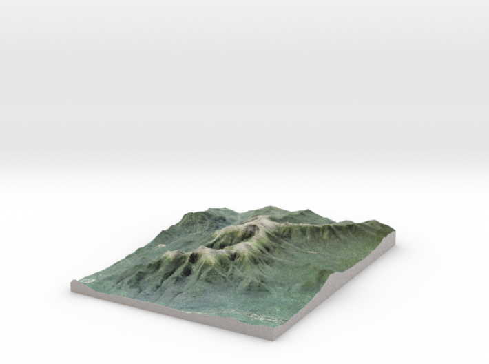
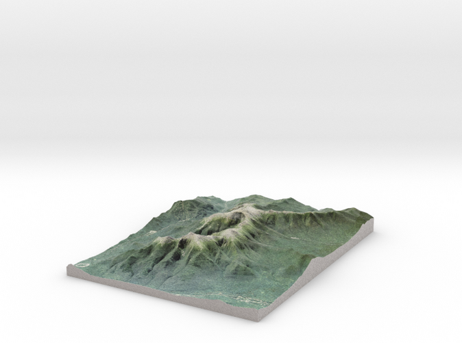
Mount Washington, called Agiocochook by some Native American tribes, is the highest peak in the Northeastern United States at 6,288.2 ft (1,916.6 m) and the most prominent mountain east of the Mississippi River.
The mountain is notorious for its erratic weather. On the afternoon of April 12, 1934, the Mount Washington Observatory recorded a windspeed of 231 miles per hour (372 km/h) at the summit, the world record for most of the 20th century, and still a record for measured wind speeds not involved with a tropical cyclone.[4][a]
The mountain is located in the Presidential Range of the White Mountains, in the township of Sargent's Purchase, Coös County, New Hampshire. While nearly the whole mountain is in the White Mountain National Forest, an area of 60.3 acres (24.4 ha) surrounding and including the summit is occupied by Mount Washington State Park.
The Mount Washington Cog Railway ascends the western slope of the mountain, and the Mount Washington Auto Road climbs to the summit from the east. The mountain is popular with hikers (the Appalachian Trail crosses the summit). Other common activities include glider flying, and annual cycle and running races such as the Auto Road Bicycle Hillclimb and Road Race.
Source: Wikipedia
The model is created at a scale of 1:65,000 with 1.5x vertical exaggeration. It features a built-in base, so it sits perfectly on a desk or in a frame.
Model Data Sources: USDA, USGS
If you would like a custom relief map, contact me through my website or through Shapeways.
Check out some photos of my other work here.
Mount Washington, called Agiocochook by some Native American tribes, is the highest peak in the Northeastern United States at 6,288.2 ft (1,916.6 m) and the most prominent mountain east of the Mississippi River.
The mountain is notorious for its erratic weather. On the afternoon of April 12, 1934, the Mount Washington Observatory recorded a windspeed of 231 miles per hour (372 km/h) at the summit, the world record for most of the 20th century, and still a record for measured wind speeds not involved with a tropical cyclone.[4][a]
The mountain is located in the Presidential Range of the White Mountains, in the township of Sargent's Purchase, Coös County, New Hampshire. While nearly the whole mountain is in the White Mountain National Forest, an area of 60.3 acres (24.4 ha) surrounding and including the summit is occupied by Mount Washington State Park.
The Mount Washington Cog Railway ascends the western slope of the mountain, and the Mount Washington Auto Road climbs to the summit from the east. The mountain is popular with hikers (the Appalachian Trail crosses the summit). Other common activities include glider flying, and annual cycle and running races such as the Auto Road Bicycle Hillclimb and Road Race.
Source: Wikipedia
The model is created at a scale of 1:65,000 with 1.5x vertical exaggeration. It features a built-in base, so it sits perfectly on a desk or in a frame.
Model Data Sources: USDA, USGS
Details
What's in the box:
NH-MountWashington-8.5x11
Dimensions:
Success Rate:
First To try.
What's this?
Rating:
Mature audiences only.


