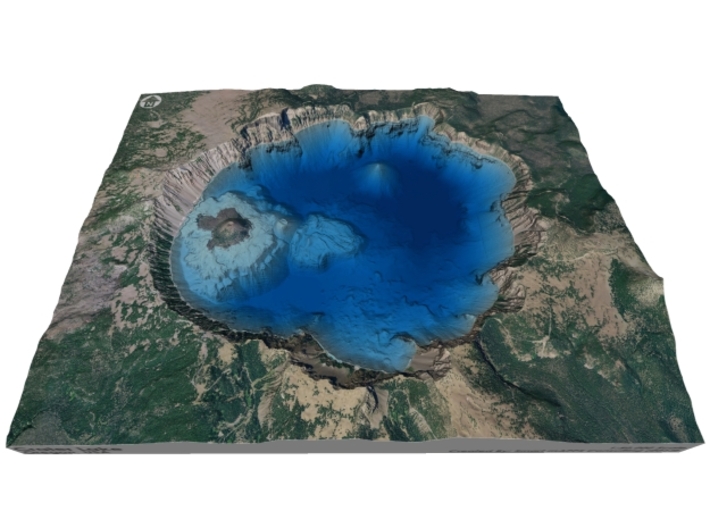


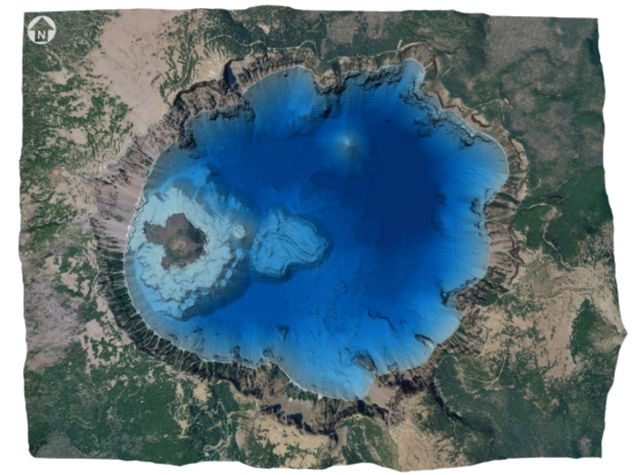

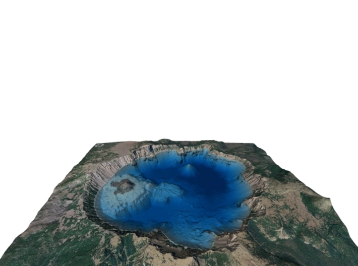

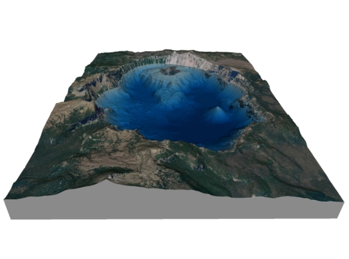


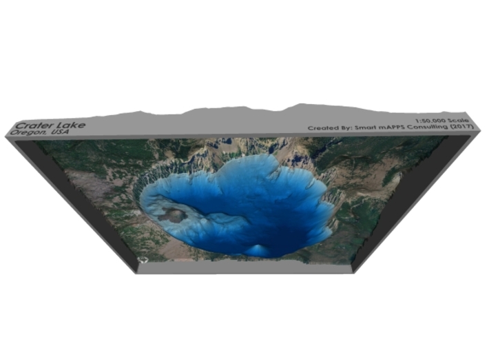


Crater Lake Bathymetry Map
Made by
Print With Shapeways
 Choose Your Material
 Choose your color and finish
$350.81
Have a question about this product?
contact the designerYou must be logged in and verified to contact the designer.
Product Description
Interactive 3D View
If you would like a custom relief map, contact me through my website or through Shapeways.
Check out some photos of my other work here.
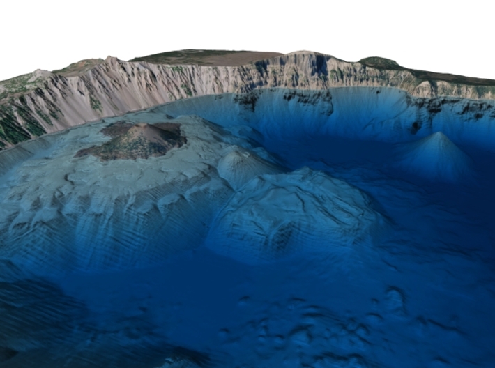
Crater Lake (Klamath: giiwas[1]) is a caldera lake in south-central Oregon in the western United States. It is the main feature of Crater Lake National Park and is famous for its deep blue color and water clarity. The lake partly fills a nearly 2,148-foot (655 m)-deep caldera[2] that was formed around 7,700 (± 150) years ago[3] by the collapse of the volcano Mount Mazama. There are no rivers flowing into or out of the lake; the evaporation is compensated for by rain and snowfall at a rate such that the total amount of water is replaced every 250 years. With a depth of 1,949 feet (594 m),[4]the lake is the deepest in the United States. In the world, it ranks ninth for maximum depth, and third for mean (average) depth.[5]
Crater Lake is also known for the "Old Man of the Lake", a full-sized tree which is now a stump that has been bobbing vertically in the lake for over a century.[6][7] The low temperature of the water has slowed the decomposition of the wood, hence the longevity of the bobbing tree.
Crater Lake features two small islands. Wizard Island, located near the western shore of the lake, is a cinder cone approximately 316 acres (128 ha) in size. Phantom Ship, a natural rock pillar, is located near the southern shore.
While having no indigenous fish population, the lake was stocked from 1888 to 1941 with a variety of fish. Several species have formed self-sustaining populations.[8] Since 2002, one of the state's regular-issue license plate designs has featured Crater Lake.[9] The commemorative Oregon State Quarter, which was released by the United States Mint in 2005, features an image of Crater Lake on its reverse.
Source: Wikipedia
The model is created at a scale of 1:50,000 with 1.25x vertical exaggeration. It features a built-in base, so it sits perfectly on a desk or in a frame.
Model Data Sources: USDA, USGS
If you would like a custom relief map, contact me through my website or through Shapeways.
Check out some photos of my other work here.
Crater Lake (Klamath: giiwas[1]) is a caldera lake in south-central Oregon in the western United States. It is the main feature of Crater Lake National Park and is famous for its deep blue color and water clarity. The lake partly fills a nearly 2,148-foot (655 m)-deep caldera[2] that was formed around 7,700 (± 150) years ago[3] by the collapse of the volcano Mount Mazama. There are no rivers flowing into or out of the lake; the evaporation is compensated for by rain and snowfall at a rate such that the total amount of water is replaced every 250 years. With a depth of 1,949 feet (594 m),[4]the lake is the deepest in the United States. In the world, it ranks ninth for maximum depth, and third for mean (average) depth.[5]
Crater Lake is also known for the "Old Man of the Lake", a full-sized tree which is now a stump that has been bobbing vertically in the lake for over a century.[6][7] The low temperature of the water has slowed the decomposition of the wood, hence the longevity of the bobbing tree.
Crater Lake features two small islands. Wizard Island, located near the western shore of the lake, is a cinder cone approximately 316 acres (128 ha) in size. Phantom Ship, a natural rock pillar, is located near the southern shore.
While having no indigenous fish population, the lake was stocked from 1888 to 1941 with a variety of fish. Several species have formed self-sustaining populations.[8] Since 2002, one of the state's regular-issue license plate designs has featured Crater Lake.[9] The commemorative Oregon State Quarter, which was released by the United States Mint in 2005, features an image of Crater Lake on its reverse.
Source: Wikipedia
The model is created at a scale of 1:50,000 with 1.25x vertical exaggeration. It features a built-in base, so it sits perfectly on a desk or in a frame.
Model Data Sources: USDA, USGS
Details
What's in the box:
CraterLake-Bathymetry-8.5x11-50k

Dimensions:
Success Rate:
First To try.
What's this?
Rating:
Mature audiences only.


