


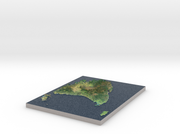
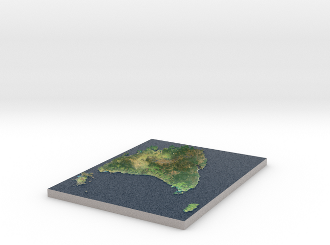
Tasmania Map, Australia
Made by
Print With Shapeways
 Choose Your Material
 Choose your color and finish
$275.46
Have a question about this product?
contact the designerYou must be logged in and verified to contact the designer.
Product Description
Interactive 3D View
If you would like a custom relief map, contact me through my website or through Shapeways.
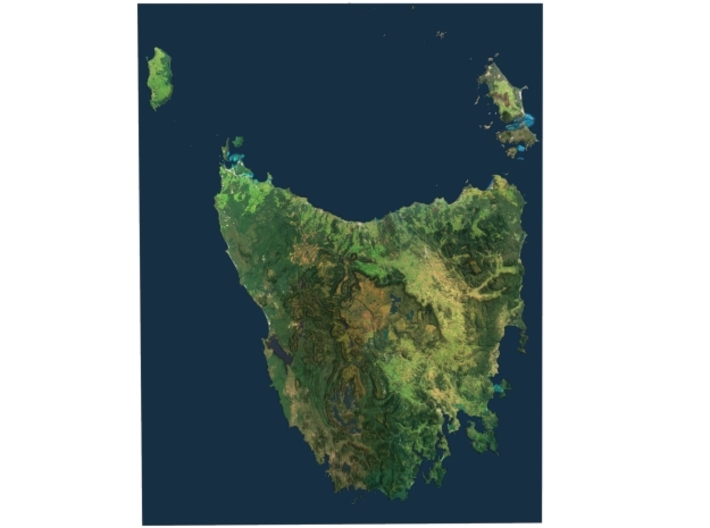
Tasmania (abbreviated as Tas and known colloquially as "Tassie") is an island state of Australia. It is located 240 km (150 mi) to the south of the Australian mainland, separated by the Bass Strait. The state encompasses the main island of Tasmania, the 26th-largest island in the world, and the surrounding 334 islands.[12]The state has a population of around 519,100[1] as of June 2016, just over forty percent of which resides in the Greater Hobart precinct, which forms the metropolitan area of the state capital and largest city, Hobart.
Tasmania's area is 68,401 km2 (26,410 sq mi), of which the main island covers 64,519 km2 (24,911 sq mi).[13]Promoted as a natural state; protected areas of Tasmania cover about 42% of the land area of the state, which includes national parks and World Heritage Sites.[14] Tasmania was the founding place of the first environmental party in the world.[15] Though an island state, due to a mapping error the state shares a land border with Victoria at its northernmost terrestrial point, Boundary Islet, a nature reserve in Bass Strait. The Bishop and Clerk Islets, about 37 km south of Macquarie Island, are the southernmost terrestrial point of the state of Tasmania, and the southernmost internationally recognised land in Australia.
Source: Wikipedia
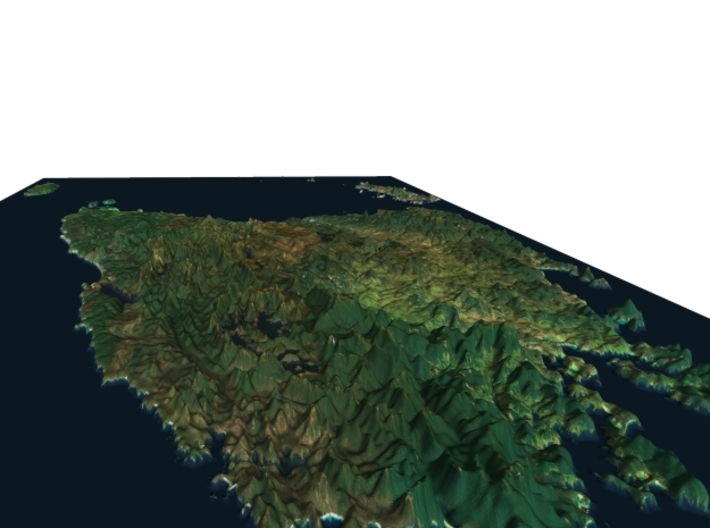
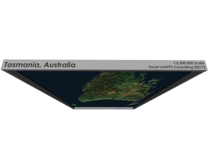
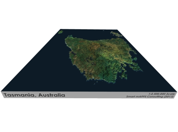
The model is created at a scale of 1:2,500,000 with 15x vertical exaggeration. It features a built-in base, so it sits perfectly on a desk or in a frame.
Model Data Sources: NASA
If you would like a custom relief map, contact me through my website or through Shapeways.
Tasmania (abbreviated as Tas and known colloquially as "Tassie") is an island state of Australia. It is located 240 km (150 mi) to the south of the Australian mainland, separated by the Bass Strait. The state encompasses the main island of Tasmania, the 26th-largest island in the world, and the surrounding 334 islands.[12]The state has a population of around 519,100[1] as of June 2016, just over forty percent of which resides in the Greater Hobart precinct, which forms the metropolitan area of the state capital and largest city, Hobart.
Tasmania's area is 68,401 km2 (26,410 sq mi), of which the main island covers 64,519 km2 (24,911 sq mi).[13]Promoted as a natural state; protected areas of Tasmania cover about 42% of the land area of the state, which includes national parks and World Heritage Sites.[14] Tasmania was the founding place of the first environmental party in the world.[15] Though an island state, due to a mapping error the state shares a land border with Victoria at its northernmost terrestrial point, Boundary Islet, a nature reserve in Bass Strait. The Bishop and Clerk Islets, about 37 km south of Macquarie Island, are the southernmost terrestrial point of the state of Tasmania, and the southernmost internationally recognised land in Australia.
Source: Wikipedia
The model is created at a scale of 1:2,500,000 with 15x vertical exaggeration. It features a built-in base, so it sits perfectly on a desk or in a frame.
Model Data Sources: NASA
Details
What's in the box:
Tasmania-8.5x11
Dimensions:
Success Rate:
First To try.
What's this?
Rating:
Mature audiences only.


