


Homer Tunnel Map, New Zealand
Made by
Print With Shapeways
 Choose Your Material
 Choose your color and finish
$499.15
Have a question about this product?
contact the designerYou must be logged in and verified to contact the designer.
Product Description
If you would like a custom relief map, contact me through my website or through Shapeways.
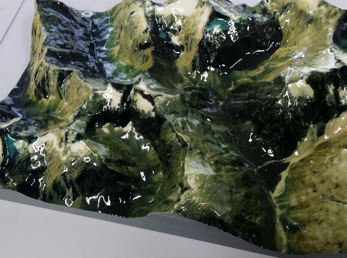
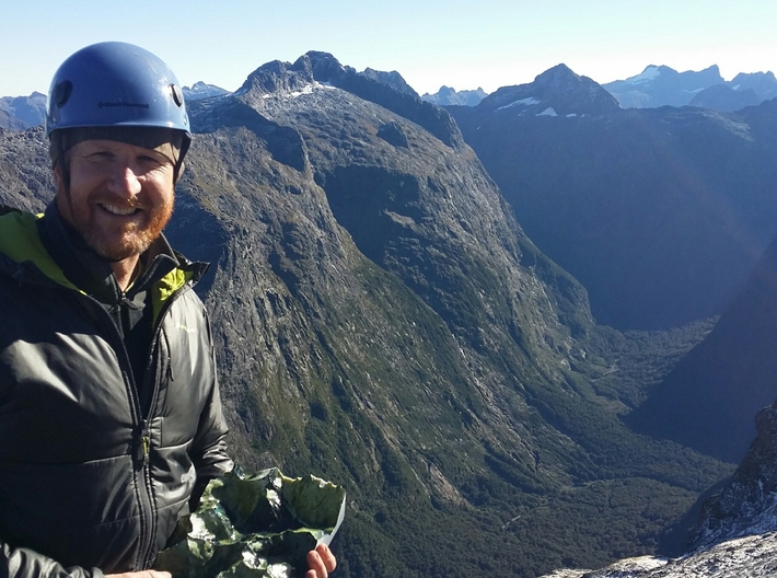
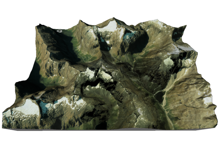
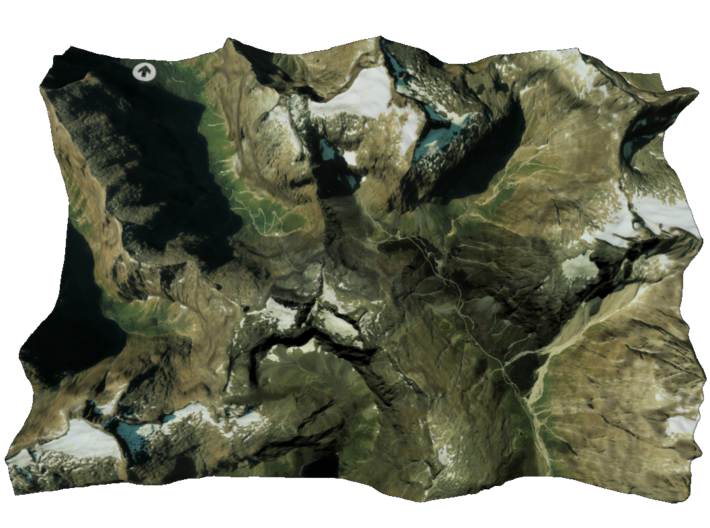
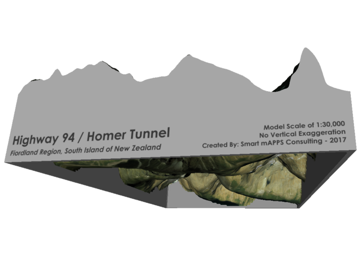
The Homer Tunnel is a 1.2 km (0.75 miles) long road tunnel in the Fiordland region of the South Island of New Zealand, opened in 1953. New Zealand State Highway 94 passes through the tunnel, linking Milford Sound to Te Anau and Queenstown, by piercing the Darran Mountain range at the Homer Saddle.[1] It connects between the valley of the Hollyford River to the east and that of the Cleddau to the west. The tunnel is straight and was originally single-lane and gravel-surfaced. The tunnel walls remain unlined granite. The east portal end is at 945 m elevation; the tunnel runs 1270 m at approximately a 1:10 gradient down to the western portal.[2] Until it was sealed and enlarged it was the longest gravel-surfaced tunnel in the world.
Source: Wikipedia
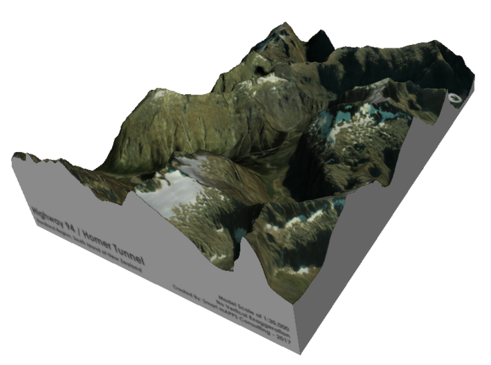
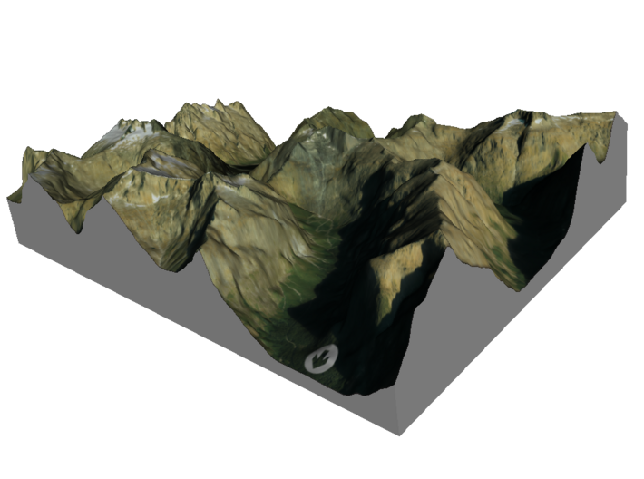
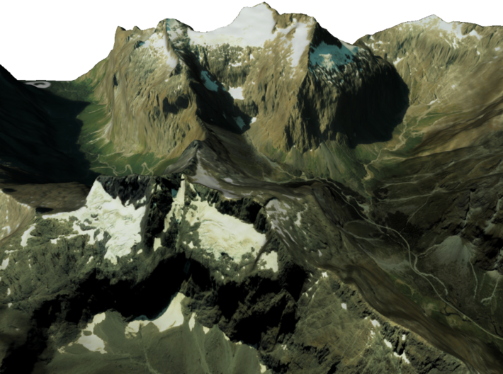
The model is created at a scale of 1:30,000 with no vertical exaggeration. It features a built-in base, so it sits perfectly on a desk or in a frame.
Model Data Sources: Land Information New Zealand (LINZ)
The Homer Tunnel is a 1.2 km (0.75 miles) long road tunnel in the Fiordland region of the South Island of New Zealand, opened in 1953. New Zealand State Highway 94 passes through the tunnel, linking Milford Sound to Te Anau and Queenstown, by piercing the Darran Mountain range at the Homer Saddle.[1] It connects between the valley of the Hollyford River to the east and that of the Cleddau to the west. The tunnel is straight and was originally single-lane and gravel-surfaced. The tunnel walls remain unlined granite. The east portal end is at 945 m elevation; the tunnel runs 1270 m at approximately a 1:10 gradient down to the western portal.[2] Until it was sealed and enlarged it was the longest gravel-surfaced tunnel in the world.
Source: Wikipedia
The model is created at a scale of 1:30,000 with no vertical exaggeration. It features a built-in base, so it sits perfectly on a desk or in a frame.
Model Data Sources: Land Information New Zealand (LINZ)
Details
What's in the box:
HomerTunnel-A4

Dimensions:
Success Rate:
First To try.
What's this?
Rating:
Mature audiences only.


