


Wisconsin Relief Map
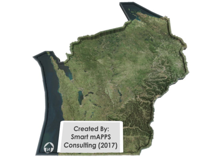
Made by
Print With Shapeways
 Choose Your Material
 Choose your color and finish
$181.74
Have a question about this product?
contact the designerYou must be logged in and verified to contact the designer.
Product Description
Interactive 3D View
If you would like a custom relief map, contact me through my website or through Shapeways. Check out photos of my other 3D prints.
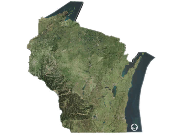
Wisconsin is a U.S. state located in the north-central United States, in the Midwest and Great Lakes regions. It is bordered by Minnesota to the west, Iowa to the southwest, Illinois to the south, Lake Michigan to the east, Michigan to the northeast, and Lake Superior to the north. Wisconsin is the 23rd largest state by total area and the 20th most populous. The state capital is Madison, and its largest city is Milwaukee, which is located on the western shore of Lake Michigan. The state is divided into 72 counties.
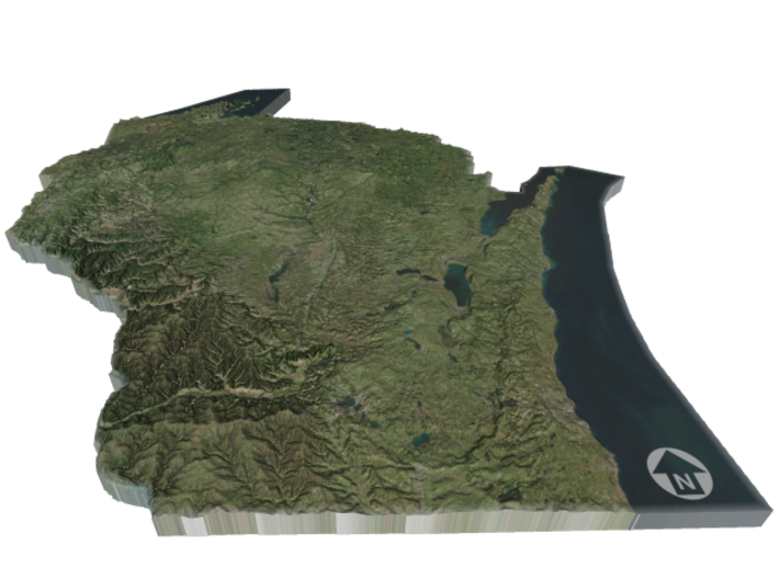
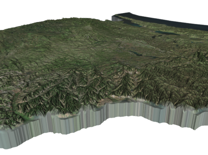
Wisconsin's geography is diverse, with the Northern Highland and Western Upland along with a part of the Central Plainoccupying the western part of the state and lowlands stretching to the shore of Lake Michigan. Wisconsin is second to Michigan in the length of its Great Lakes coastline.
Wisconsin is known as "America's Dairyland" because it is one of the nation's leading dairy producers, particularly famous for its cheese. Manufacturing, especially paper products, information technology (IT), and tourism are also major contributors to the state's economy.
Source: Wikipedia
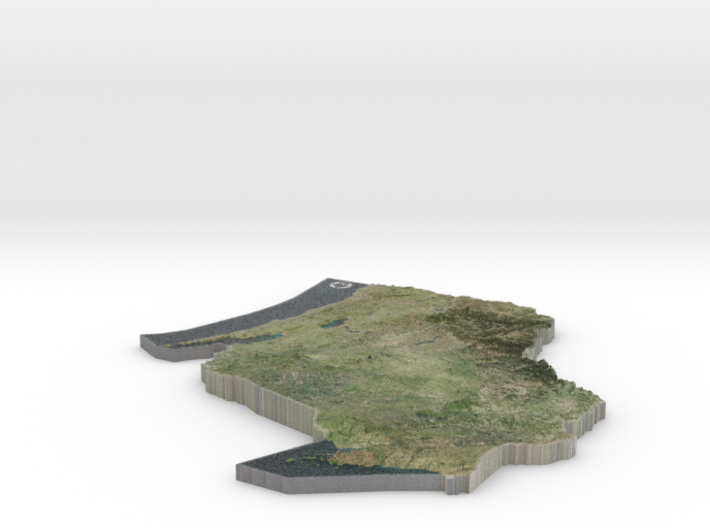
The model is created at a scale of 1:3,400,000 with 50x vertical exaggeration. It features a built-in base, so it sits perfectly on a desk or in a frame.
Model Data Sources: NASA
If you would like a custom relief map, contact me through my website or through Shapeways. Check out photos of my other 3D prints.
Wisconsin is a U.S. state located in the north-central United States, in the Midwest and Great Lakes regions. It is bordered by Minnesota to the west, Iowa to the southwest, Illinois to the south, Lake Michigan to the east, Michigan to the northeast, and Lake Superior to the north. Wisconsin is the 23rd largest state by total area and the 20th most populous. The state capital is Madison, and its largest city is Milwaukee, which is located on the western shore of Lake Michigan. The state is divided into 72 counties.
Wisconsin's geography is diverse, with the Northern Highland and Western Upland along with a part of the Central Plainoccupying the western part of the state and lowlands stretching to the shore of Lake Michigan. Wisconsin is second to Michigan in the length of its Great Lakes coastline.
Wisconsin is known as "America's Dairyland" because it is one of the nation's leading dairy producers, particularly famous for its cheese. Manufacturing, especially paper products, information technology (IT), and tourism are also major contributors to the state's economy.
Source: Wikipedia
The model is created at a scale of 1:3,400,000 with 50x vertical exaggeration. It features a built-in base, so it sits perfectly on a desk or in a frame.
Model Data Sources: NASA
Details
What's in the box:
Wisconsin

Dimensions:
Success Rate:
First To try.
What's this?
Rating:
Mature audiences only.


