


Mount Robson Map: 8"
Made by
Print With Shapeways
 Choose Your Material
 Choose your color and finish
$255.06
Have a question about this product?
contact the designerYou must be logged in and verified to contact the designer.
Product Description
Interactive 3D View
If you would like a custom relief map, contact me through my website or through Shapeways. Check out photos of my other 3D prints.
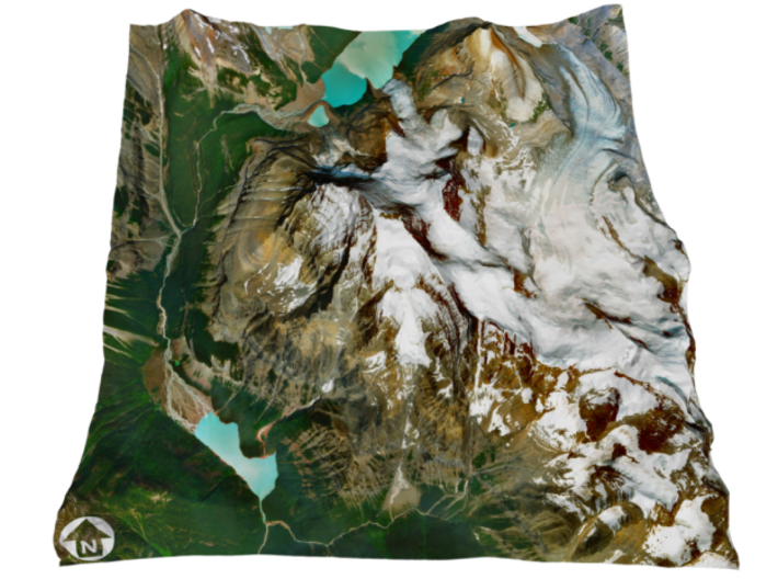
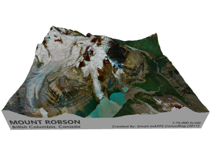
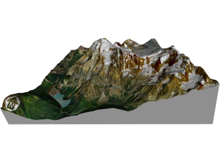
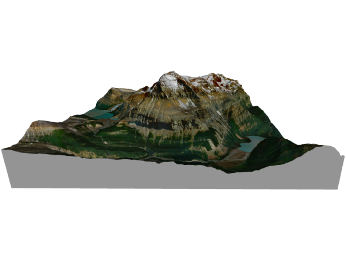
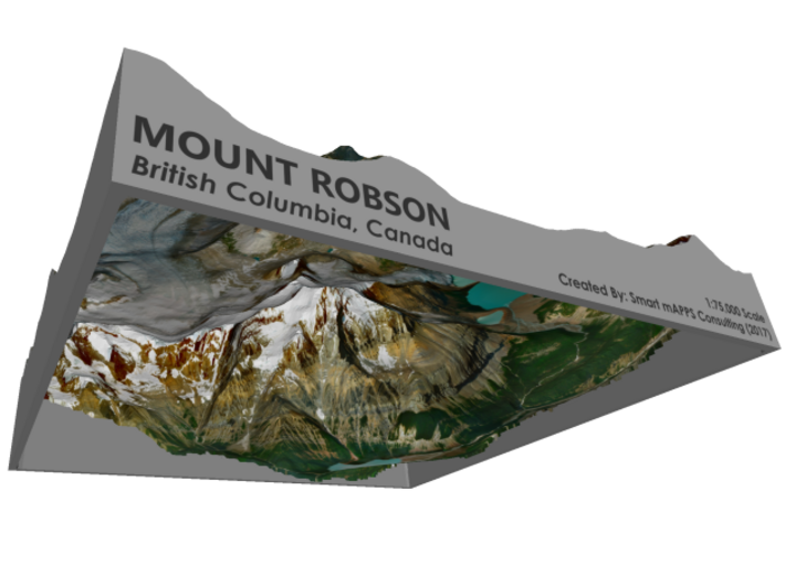
Mount Robson is the most prominent mountain in North America's Rocky Mountain range; it is also the highest point in the Canadian Rockies. The mountain is located entirely within Mount Robson Provincial Park of British Columbia, and is part of the Rainbow Range. Mount Robson is the second highest peak entirely in British Columbia, behind Mount Waddington in the Coast Range. The south face of Mount Robson is clearly visible from the Yellowhead Highway (Highway 16), and is commonly photographed along this route.
Mount Robson was likely named after Colin Robertson, who worked for both the North West Company and the Hudson’s Bay Company at various times in the early 19th century, though there was confusion over the name as many assumed it to have been named for John Robson, an early premier of British Columbia. The Texqakallt, a Secwepemc people and the earliest inhabitants of the area, call it Yuh-hai-has-kun, The Mountain of the Spiral Road.[4] Other unofficial names include Cloud Cap Mountain.[2]
Source: Wikpedia
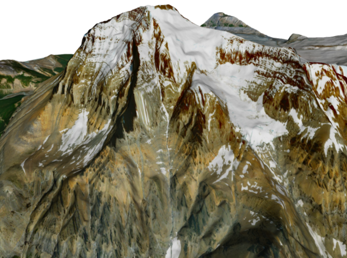
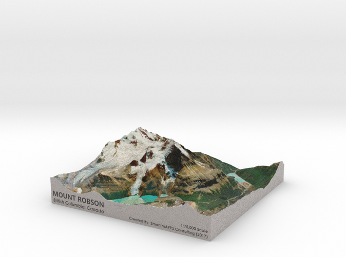
The model is created at a scale of 1:75,000 with 1.5x vertical exaggeration. It features a built-in base, so it sits perfectly on a desk or in a frame.
Model Data Sources: Canadian Government
If you would like a custom relief map, contact me through my website or through Shapeways. Check out photos of my other 3D prints.
Mount Robson is the most prominent mountain in North America's Rocky Mountain range; it is also the highest point in the Canadian Rockies. The mountain is located entirely within Mount Robson Provincial Park of British Columbia, and is part of the Rainbow Range. Mount Robson is the second highest peak entirely in British Columbia, behind Mount Waddington in the Coast Range. The south face of Mount Robson is clearly visible from the Yellowhead Highway (Highway 16), and is commonly photographed along this route.
Mount Robson was likely named after Colin Robertson, who worked for both the North West Company and the Hudson’s Bay Company at various times in the early 19th century, though there was confusion over the name as many assumed it to have been named for John Robson, an early premier of British Columbia. The Texqakallt, a Secwepemc people and the earliest inhabitants of the area, call it Yuh-hai-has-kun, The Mountain of the Spiral Road.[4] Other unofficial names include Cloud Cap Mountain.[2]
Source: Wikpedia
The model is created at a scale of 1:75,000 with 1.5x vertical exaggeration. It features a built-in base, so it sits perfectly on a desk or in a frame.
Model Data Sources: Canadian Government
Details
What's in the box:
Mt-Robson-8x8-75k
Dimensions:
Success Rate:
First To try.
What's this?
Rating:
Mature audiences only.


