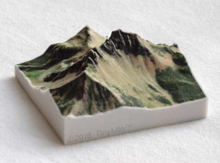


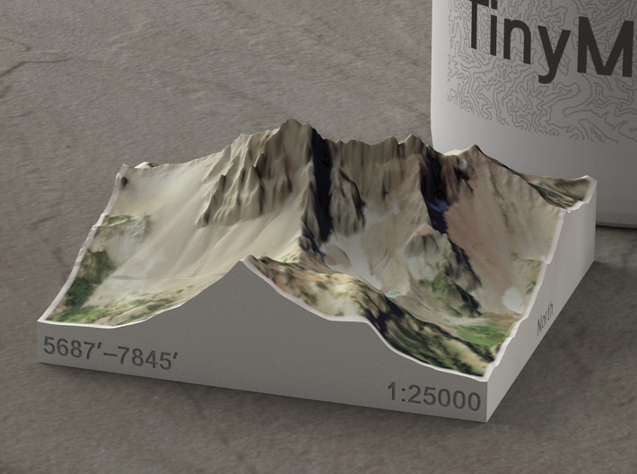


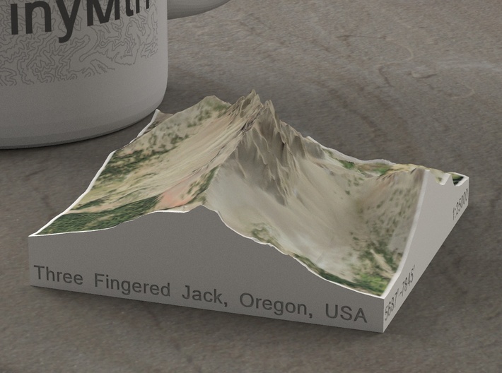


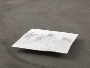
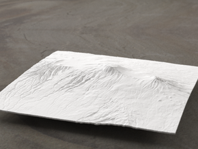
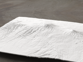
Three Fingered Jack, Oregon, USA, 1:25000
Made by
Print With Shapeways
 Choose Your Material
 Choose your color and finish
$47.00
Have a question about this product?
contact the designerYou must be logged in and verified to contact the designer.
Product Description
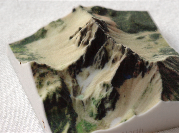
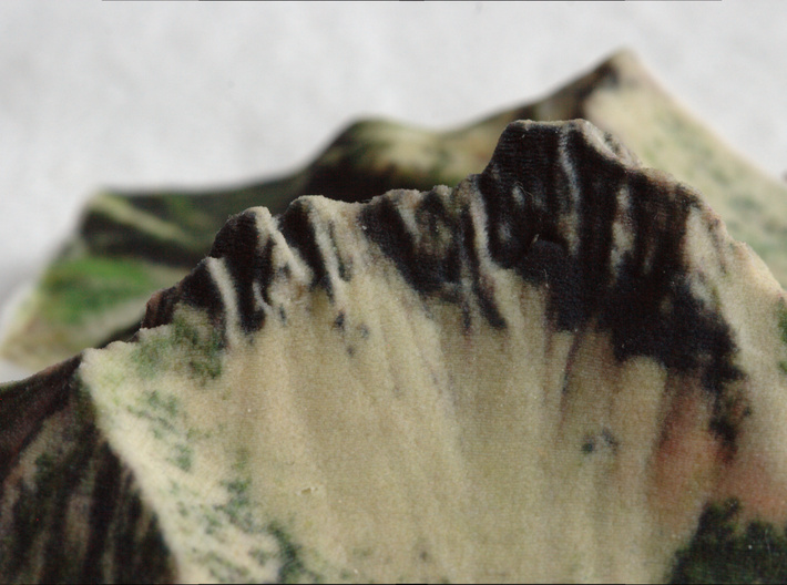
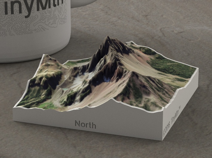
Three Fingered Jack is a small, heavily-eroded shield volcano in Linn County, Oregon, not far from Bend (those lucky bastards). Its distinctive shape---a narrow dike of rock for a summit---is seen by hikers on the Pacific Crest Trail as they pass over the mountain's West flank. This model focuses on the peak itself and its connecting ridges.
This model was generated from both the traditional one-third arcsecond digital elevation model and recent LiDAR scans of the area. Without the new, high-resolution laser scans, this model would look less steep and exciting, and significantly less realistic. It's my goal to meld the terrific terrain data coming out of the USGS with my artistic eye for landscape to create miniature works of art that are also very accurate representations of the real world.
Model scale is 1:25000
Model measures 2.8" x 2.8" x 1.28" (7.1 x 7.1 x 3.3 cm)
Original area is approximately 1.1 by 1.1 miles
Altitudes covered: 5687' to 7845'
There is no vertical exaggeration applied to this model. This is a true-to-life scale model of a real place.
Click here for more sizes.
Click here for other 1:25000 models.
TinyMtn models are most affordable in the "Sandstone" and "White Natural Versatile Plastic" materials. This model is in "Sandstone," which is a glued gypsum material. When you receive the model it will be ready for display, though it may smell funny and need some time to air out. "Sandstone" models are much more brittle than "Versatile Plastic" models, but feel more like light stone. Do not soak it in water, though you can safely seal it with Polycrylic or a similar water-based clear spray sealant. Read more about this popular material here.
All TinyMtn models have hollow bottoms - this is to save on weight, and thus cost. Many larger models also have extra flanges on their undersides to increase rigidity and strength. To make the model more solid, you should feel free to carefully pour resin into the bottom cavity, or glue a properly-sized slab of wood or another material into it.
These models have been optimized for the above materials, and are not offered in other materials for strength or cost reasons. If you need one in another material, please tinymtnbiz@gmail.com and we'll do our best to fulfill your request.
(C) 2016 TinyMtn (TM)
Model created using GDAL, NetPBM, Gmsh, Carve, MeshLab, and other custom software
Source of digital elevation and aerial orthoimagery data: U.S. Geological Survey
The USGS home page is https://www.usgs.gov/
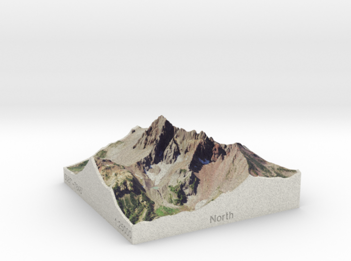
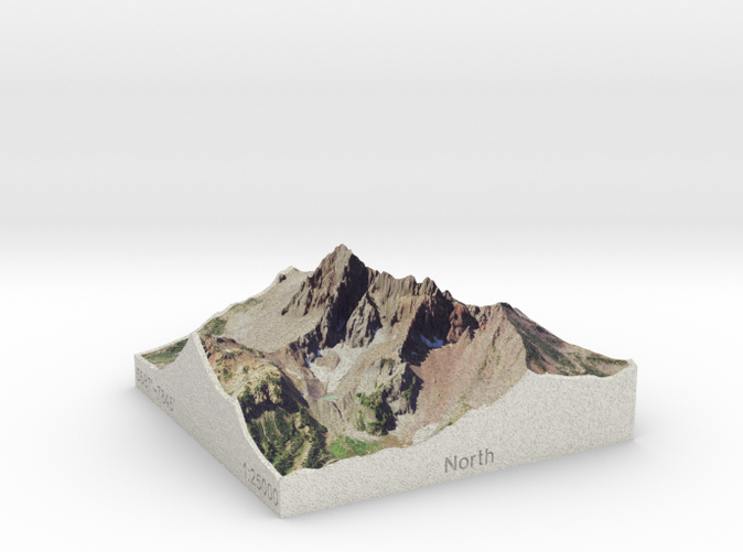
Details
What's in the box:
Three Fingered Jack, Oregon, USA, 1:25000
Dimensions:
Success Rate:
First To try.
What's this?
Rating:
Mature audiences only.
