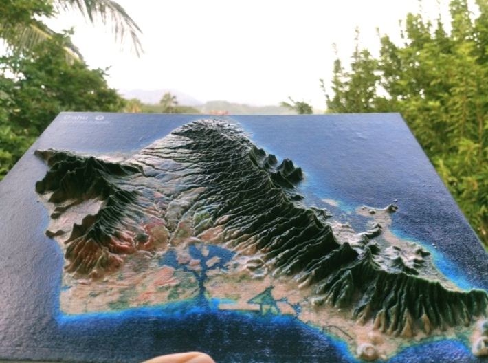
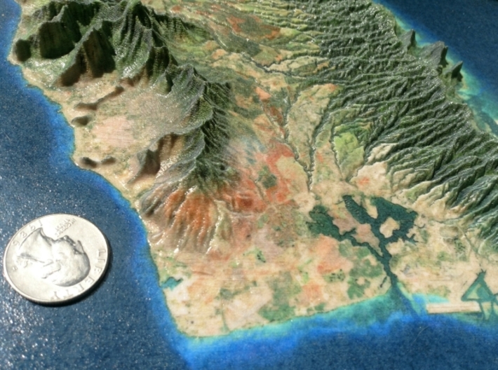
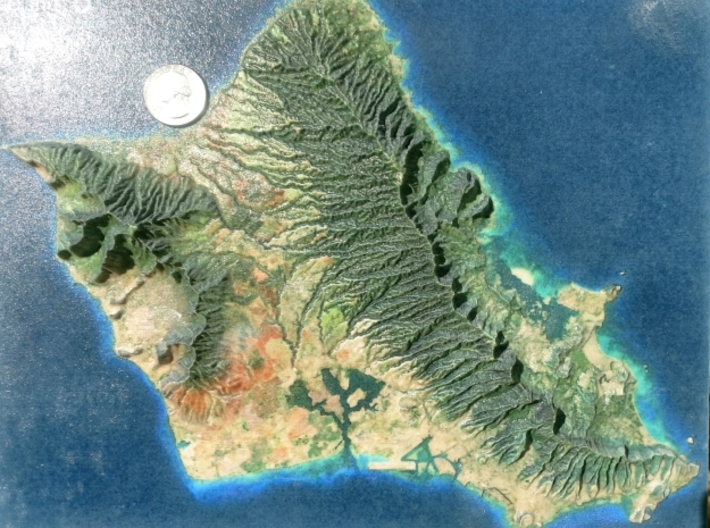
Customer Photo


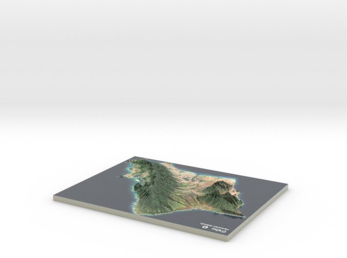
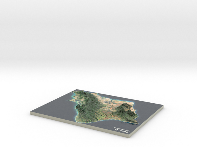
Oahu Map, Hawaiian Islands
Made by
Print With Shapeways
 Choose Your Material
 Choose your color and finish
$301.40
Have a question about this product?
contact the designerYou must be logged in and verified to contact the designer.
Product Description
Interactive 3D View
If you would like a custom relief map, contact me through my website or through Shapeways. Check out photos of my other 3D prints.
Oʻahu (pronounced [oˈʔɐhu]) or Oahu /oʊˈɑːhuː/, known as "The Gathering Place", is the third largest of the Hawaiian Islands. It is home to about two-thirds of the population of the U.S. state of Hawaii. The state capital, Honolulu, is on Oʻahu's southeast coast. Including small close-in offshore islands such as Ford Island and the islands in Kāneʻohe Bay and off the eastern (windward) coast, it has a total land area of 596.7 square miles (1,545.4 km2), making it the 20th largest island in the United States.[1] Along with the rest of the Hawaiian Islands, Oahu is one of the largest and northernmost islands of Polynesia.
In the greatest dimension, this volcanic island is 44 miles (71 km) long and 30 miles (48 km) across. The length of the shoreline is 227 miles (365 km). The island is the result of two separate shield volcanoes: the Waiʻanae and Koʻolau Ranges, with a broad "valley" or saddle (the central Oʻahu Plain) between them. The highest point is Kaʻala in the Waiʻanae Range, rising to 4,003 feet (1,220 m) above sea level.[2]
Source: Wikipedia
This model is created at a scale of 1:260,000 with 4x vertical exaggeration. It features a built-in base, so it sits perfectly on a desk or in a frame.
Model Data Sources: USGS
Details
What's in the box:
Oahu 8.5x11
Dimensions:
Success Rate:
First To try.
What's this?
Rating:
Mature audiences only.


