


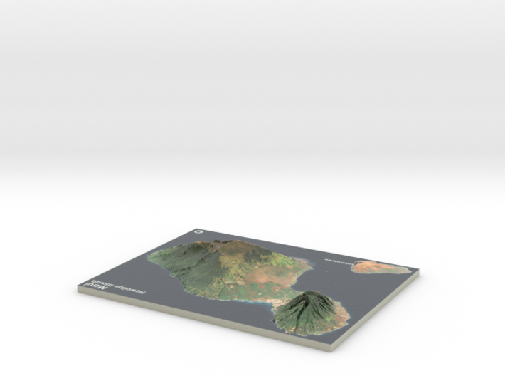
Maui Map, Hawaiian Islands
Made by
Print With Shapeways
 Choose Your Material
 Choose your color and finish
$298.90
Have a question about this product?
contact the designerYou must be logged in and verified to contact the designer.
Product Description
Interactive 3D View
If you would like a custom relief map, contact me through my website or through Shapeways. Check out photos of my other 3D prints.
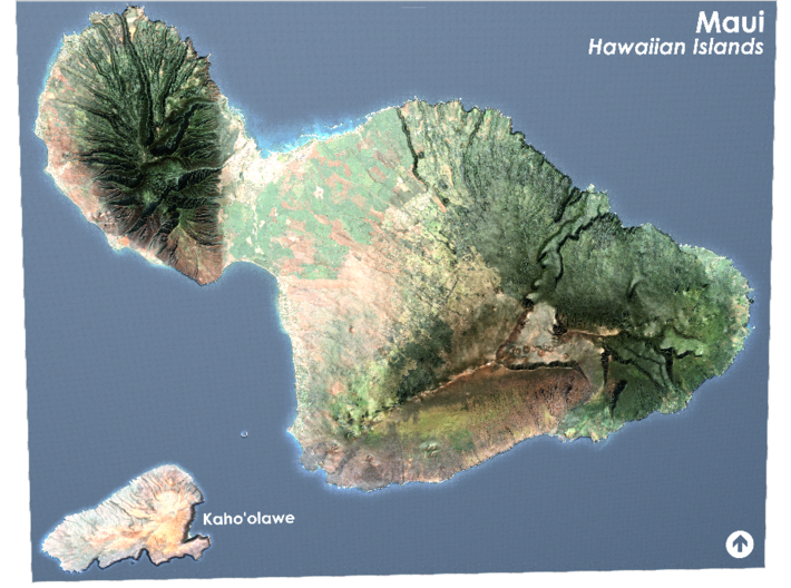
The island of Maui (/ˈmaʊ.iː/; Hawaiian: [ˈmɐwwi])[3] is the second-largest of the Hawaiian Islands at 727.2 square miles (1,883 km2) and is the 17th largest island in the United States.[4] Maui is part of the State of Hawaii and is the largest of Maui County's four islands, bigger than Molokaʻi, Lānaʻi, and unpopulated Kahoʻolawe. In 2010, Maui had a population of 144,444, third-highest of the Hawaiian Islands, behind that of Oʻahu and Hawaiʻi Island. Kahului is the largest census-designated place (CDP) on the island with a population of 26,337 as of 2010 and is the commercial and financial hub of the island.[5] Wailuku is the seat of Maui County and is the third-largest CDP as of 2010. Other significant places include Kīhei (including Wailea and Makena in the Kihei Town CDP, which is the second-most-populated CDP in Maui), Lahaina (including Kāʻanapali and Kapalua in the Lahaina Town CDP), Makawao, Pāʻia, Kula, Haʻikū, and Hāna.
Source: Wikipeida
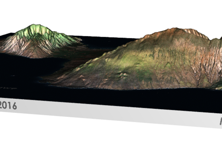
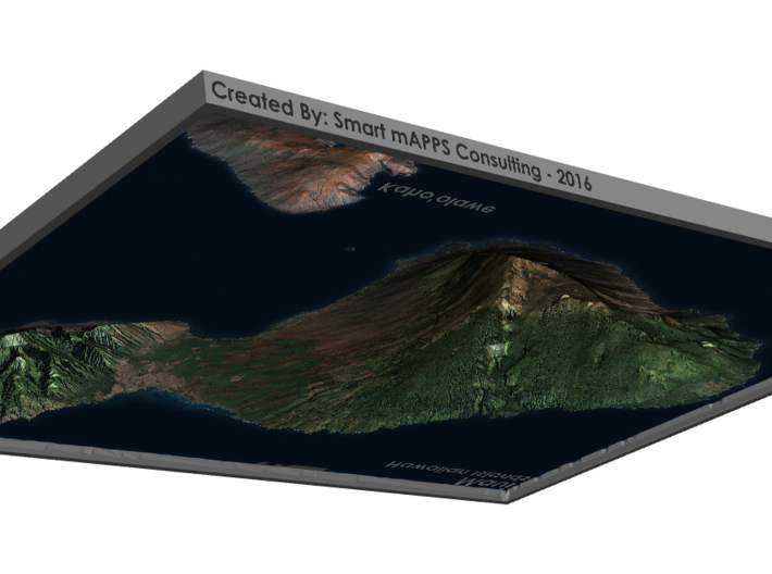
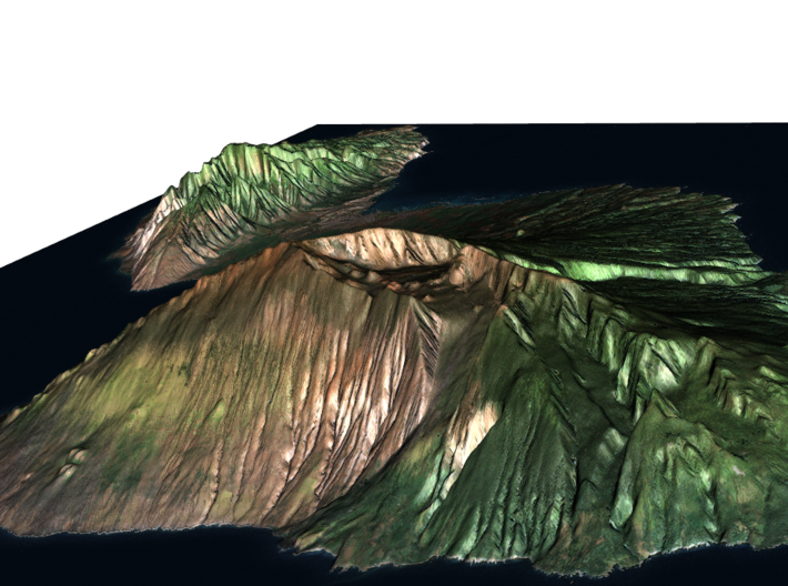
This model is created at a scale of 1:300,000 with 2.75x vertical exaggeration. It features a built-in base, so it sits perfectly on a desk or in a frame.
Model Data Sources: USGS
If you would like a custom relief map, contact me through my website or through Shapeways. Check out photos of my other 3D prints.
The island of Maui (/ˈmaʊ.iː/; Hawaiian: [ˈmɐwwi])[3] is the second-largest of the Hawaiian Islands at 727.2 square miles (1,883 km2) and is the 17th largest island in the United States.[4] Maui is part of the State of Hawaii and is the largest of Maui County's four islands, bigger than Molokaʻi, Lānaʻi, and unpopulated Kahoʻolawe. In 2010, Maui had a population of 144,444, third-highest of the Hawaiian Islands, behind that of Oʻahu and Hawaiʻi Island. Kahului is the largest census-designated place (CDP) on the island with a population of 26,337 as of 2010 and is the commercial and financial hub of the island.[5] Wailuku is the seat of Maui County and is the third-largest CDP as of 2010. Other significant places include Kīhei (including Wailea and Makena in the Kihei Town CDP, which is the second-most-populated CDP in Maui), Lahaina (including Kāʻanapali and Kapalua in the Lahaina Town CDP), Makawao, Pāʻia, Kula, Haʻikū, and Hāna.
Source: Wikipeida
This model is created at a scale of 1:300,000 with 2.75x vertical exaggeration. It features a built-in base, so it sits perfectly on a desk or in a frame.
Model Data Sources: USGS
Details
What's in the box:
Maui-8.5x11

Dimensions:
Success Rate:
First To try.
What's this?
Rating:
Mature audiences only.


